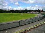
Prestonville, Brighton

Prestonville is a largely residential area in the northwest of Brighton, part of the English city of Brighton and Hove. It covers a long, narrow and steeply sloping ridge of land between the Brighton Main Line and Dyke Road, two major transport corridors which run north-northwestwards from the centre of Brighton. Residential development started in the 1860s and spread northwards, further from central Brighton, over the next six decades. The area is characterised by middle-class and upper-middle-class housing in various styles, small-scale commercial development and long eastward views across the city. Two Anglican churches serve Prestonville—one at each end of the area—and there are several listed buildings. Brighton and Hove City Council describe the area as a "pre-1914 residential inner suburb whose street pattern, architecture and character have been well preserved", giving a "strong sense of place". "High-quality" Victorian buildings can be found amongst the housing, and two residential streets consist of a homogeneous "railway suburb" built by the London, Brighton and South Coast Railway to rehouse people displaced from around Brighton station when the company extended its goods yard. While not successful in this aim, the estate left "a legacy of good-quality housing" which still survives.
Excerpt from the Wikipedia article Prestonville, Brighton (License: CC BY-SA 3.0, Authors, Images).Prestonville, Brighton
Port Hall Street, Brighton Prestonville
Geographical coordinates (GPS) Address Nearby Places Show on map
Geographical coordinates (GPS)
| Latitude | Longitude |
|---|---|
| N 50.8374 ° | E -0.1511 ° |
Address
Port Hall Street
Port Hall Street
BN1 5PJ Brighton, Prestonville
England, United Kingdom
Open on Google Maps


