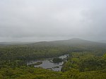
Mount Watatic

Mount Watatic is a 1,832-foot (558 m) monadnock located just south of the Massachusetts–New Hampshire border, in the United States, at the southern end of the Wapack Range. It lies in Ashburnham, Massachusetts and Ashby, Massachusetts. The 22-mile (35 km) Wapack Trail and the 92-mile (148 km) Midstate Trail both cross the mountain. The name is probably a corruption of the Native American term Wetu-tick, "wigwam brook", and probably applied first to the nearby large stream and thereafter to the mountain and the pond.The east and south side of the mountain drains into the Souhegan River watershed, to the Merrimack River thence the Atlantic Ocean; the west and north sides drain into the Millers River watershed, to the Connecticut River, thence into Long Island Sound. Mount Watatic was the site of a ski area that operated from the 1930s until 1984. An attempt to reopen the ski area in 1988 failed. Mount Watatic was also once home to state fire tower #31 that looked out over central Massachusetts, until its removal in 1996. Phone lines to the tower ran up the Ashby and Ashburnham sides of the mountain over the years.
Excerpt from the Wikipedia article Mount Watatic (License: CC BY-SA 3.0, Authors, Images).Mount Watatic
Mid State Trail,
Geographical coordinates (GPS) Address Nearby Places Show on map
Geographical coordinates (GPS)
| Latitude | Longitude |
|---|---|
| N 42.696666666667 ° | E -71.8925 ° |
Address
Mid State Trail
Massachusetts, United States
Open on Google Maps


