Islandshire
Islandshire was an area of Northumberland, England, comprising Lindisfarne or Holy Island, plus five parishes on the mainland. It is historically associated with the Bishop of Durham, and was administratively an exclave of the County Palatinate of Durham. It was transferred to the county of Northumberland by the Counties (Detached Parts) Act 1844, becoming a hundred. It formed part of the Norham and Islandshires Rural District from 1894 until 1974, and then formed part of the borough of Berwick-upon-Tweed district within the County of Northumberland. In 2009 the borough of Berwick-upon-Tweed was abolished as part of wider structural changes to local government in England, with the area now falling under the unitary council of Northumberland County Council. The area, combined with Norham, still forms one of the unitary council's electoral divisions today. It consisted of the parishes of Ancroft, Belford, Elwick, Holy Island, Kyloe and Tweedmouth.
Excerpt from the Wikipedia article Islandshire (License: CC BY-SA 3.0, Authors).Islandshire
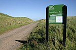
Pilgrim's Way,
Geographical coordinates (GPS) Address Nearby Places Show on map
Geographical coordinates (GPS)
| Latitude | Longitude |
|---|---|
| N 55.679 ° | E -1.862 ° |
Address
Pilgrim's Way
Pilgrim's Way
TD15 2SB , Holy Island
England, United Kingdom
Open on Google Maps


