place

Store Front Museum

1971 establishments in New York City1988 disestablishments in New York (state)African-American museums in New York CityCommunity museums in the United StatesDefunct museums in New York City
Museums disestablished in 1988Museums established in 1971Museums in Queens, New York
Storefront Museum
Storefront Museum

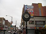
The Store Front Museum was a community museum in Queens, New York that served as a cultural center and exhibition space for the black community of the borough. Established in 1971 by artist Tom Lloyd, it was originally located on Liberty Avenue, in a former retail tire dealer building. Lloyd was an artist that had made numerous showings around the country before coming to Queens. The museum was established in February 1971 and was devoted to the promotion and dissemination of African-American culture. Lloyd chose the name because "it implies community." The gallery was used for several exhibits, concert plays, karate classes, dance instructions, and festivals over the years. Lloyd acquired many of the museum’s materials from donations.

Excerpt from the Wikipedia article Store Front Museum (License: CC BY-SA 3.0, Authors, Images).

Store Front Museum
Guy R. Brewer Boulevard, New York Queens

Geographical coordinates (GPS) Address Nearby Places
placeShow on map

Wikipedia: Store Front MuseumContinue reading on Wikipedia

Geographical coordinates (GPS)

Latitude Longitude
N 40.700819 ° E -73.795521 °
placeShow on map

Address

York College the City University of New York

Guy R. Brewer Boulevard
11434 New York, Queens
New York, United States
mapOpen on Google Maps

Storefront Museum
Storefront Museum
Share experience

Nearby Places

Beaver Pond (Queens)

Beaver Pond was a pond located in the Jamaica section of Queens, New York. Water flowed out of the pond through Baisley Creek towards Baisley Pond. From there, it flowed through Cornell Creek into Jamaica Bay.The stream was formed by beavers prior to human settlement. The local Lenape native word for beaver, Jameco, became the namesake of the English settlement to the north of the pond, which became known as Jamaica. Beaver Pond's namesake animal was a vital component in the colonial economy. Beaver fur attracted Dutch colonists to the region and the animal appears on the seal of New York City. English settlers arrived in the area in 1656, with permission from the New Netherlands government to build Rustdorp. Following the English takeover of the colony in 1664, the popular name Jamaica became official and the town became the seat of Queens County in 1683.The pond's oldest neighbor is Prospect Cemetery, which accepted its first interment in 1668 and continued to perform burials until 1988.Later, the Long Island Rail Road's Main Line and Atlantic Branch were built in Jamaica. By 1834, when the railroad was constructed, the pond was considered the town's center.In the last decade of the 19th century, the pond was used by the American Ice Company as an ice harvesting site. City authorities considered the industrial use of Beaver Pond a health hazard as its outflow contributed to the Brooklyn Water Works. In April 1906, a grand jury in Queens recommended that the city fill in this "menace to the community and a drawback to the material progress of that section of Jamaica." Although Beaver Pond was filled, land atop the site remained undeveloped for another couple of decades. It is zoned for manufacturing with auto repair shops, slaughterhouses and undeveloped lots used to store car parts. Beaver Road, which follows the former pond's northern shore is the only physical reminder of this body of water.

Jamaica, Queens
Jamaica, Queens

Jamaica is a neighborhood in the New York City borough of Queens. It is mainly composed of a large commercial and retail area, though part of the neighborhood is also residential. Jamaica is bordered by Hollis to the east; St. Albans, Springfield Gardens, Rochdale Village to the southeast; South Jamaica to the south; Richmond Hill and South Ozone Park to the west; Briarwood to the northwest; and Kew Gardens Hills, Jamaica Hills, and Jamaica Estates to the north. Jamaica, originally a designation for an area greater than the current neighborhood, was settled under Dutch rule in 1656. It was originally called Rustdorp before it took its current name. Subsequently, under English rule Jamaica became the center of the "Town of Jamaica". It was the first county seat of Queens County, holding that title from 1683 to 1788, and was also the first incorporated village on Long Island. When Queens was incorporated into the City of Greater New York in 1898, both the Town of Jamaica and the Village of Jamaica were dissolved, but the neighborhood of Jamaica regained its role as county seat. Today, some locals group Jamaica's surrounding neighborhoods into an unofficial Greater Jamaica area encompassing most or all of the extent of the former town.Jamaica is the location of several government buildings such as Queens Civil Court, the civil branch of the Queens County Supreme Court, the Queens County Family Court and the Joseph P. Addabbo Federal Building, home to the Social Security Administration's Northeastern Program Service Center. The U.S. Food and Drug Administration's Northeast Regional Laboratory as well as the New York District Office are also located in Jamaica. Jamaica Center, the area around Jamaica Avenue, is a major commercial center. The New York Racing Association, based at Aqueduct Racetrack in South Ozone Park, lists its official address as Jamaica (Central Jamaica once housed NYRA's Jamaica Racetrack, now the massive Rochdale Village housing development). John F. Kennedy International Airport and the hotels nearby are also located in Jamaica. The neighborhood is located in Queens Community District 12. It is patrolled by the New York City Police Department's 103rd and 113th Precincts.