place

Ngawen

8th-century Buddhist templesArchaeological sites in IndonesiaBorobudurBuddhist temples in IndonesiaCultural Properties of Indonesia in Central Java
Religious buildings and structures in Central JavaShailendra dynasty
Ngawen temple November 2013

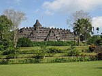
Ngawen (known locally as Candi Ngawen) is an 8th-century Buddhist temple compound in Magelang Regency, Central Java, Indonesia. Located in Ngawen village, Muntilan sub-district, 6 km (3.7 mi) to the east of Mendut temple or 5 km (3.1 mi) to the south of Muntilan town center. Ngawen temple compound consists of five temples, however today only one is successfully reconstructed. Ngawen is thought to be connected with the other three Buddhist temples nearby — Mendut, Pawon and Borobudur — all of which were built during the Sailendra dynasty (8th–9th centuries). According to the satellite map observation, the four temples; Borobudur, Pawon, Mendut and Ngawen are actually forming a straight line spanning west to east slightly tilted northeast with eastern end pointing to the peak of Mount Merapi. From the detail and style of its carving, this temple is estimated to be slightly older than Borobudur. The temple is notable for its exquisite statues of rampant lions on each corners of the temples. Since its discovery in 1874, the temple has suffered looting and artifact theft.

Excerpt from the Wikipedia article Ngawen (License: CC BY-SA 3.0, Authors, Images).

Geographical coordinates (GPS)

Latitude Longitude
N -7.6041666666667 ° E 110.2725 °
placeShow on map

Address

Candi Ngawen

Gang Jalak
56451 Muntilan
Central Java, Indonesia
mapOpen on Google Maps

linkWikiData (Q11101768)
linkOpenStreetMap (2965671737)

Ngawen temple November 2013
Share experience

Nearby Places

Kedu Plain
Kedu Plain

Kedu Plain, also known as Progo River valley, is the fertile volcanic plain that lies between the volcanoes Mount Sumbing and Mount Sundoro to the west, and Mount Merbabu and Mount Merapi to the east. It roughly corresponds to present-day Magelang and Temanggung Regency of Central Java, Indonesia. Its northern border is limited by hills of Kendal and Mount Ungaran. The plain also borders the Menoreh hills in the southwest and Prambanan Plain in the southeast. The Progo River runs through the center of this plain, from its source on the slope of Mount Sundoro to the southern coast of Java facing the Indian Ocean. It has been a significant location in Central Javanese history for over a millennium, as it contains traces of the Sailendra dynasty as well as Borobudur and associated locations. During the colonial Dutch East Indies period, the Kedu Plain was located in the Kedu Residency, which at that time covered what are now the Magelang Regency, Magelang City, and Temanggung Regency administrative units. When Britain took briefly control of the region in 1811, Magelang became the seat of government. After the Napoleonic wars ended, the English turned Java back over to the Dutch in 1816 and Magelang continued to play a central role in the Dutch East Indies. There is a small hill near Magelang called Mount Tidar that is referred to as the Nail of Java. According to Javanese legend, the gods placed the nail to prevent the island of Java from sinking into the sea from tremors.

Borobudur
Borobudur

Borobudur, also transcribed Barabudur (Indonesian: Candi Borobudur, Javanese: ꦕꦤ꧀ꦝꦶꦧꦫꦧꦸꦝꦸꦂ, romanized: Candhi Barabudhur) is a 9th-century Mahayana Buddhist temple in Magelang Regency, not far from the city of Magelang and the town of Muntilan, in Central Java, Indonesia. It is the world's largest Buddhist temple. The temple consists of nine stacked platforms, six square and three circular, topped by a central dome. It is decorated with 2,672 relief panels and originally 504 Buddha statues. The central dome is surrounded by 72 Buddha statues, each seated inside a perforated stupa.Built in the 9th century during the reign of the Sailendra Dynasty, the temple design follows Javanese Buddhist architecture, which blends the Indonesian indigenous tradition of ancestor worship and the Buddhist concept of attaining nirvāṇa. The temple demonstrates the influences of Gupta art that reflects India's influence on the region, yet there are enough indigenous scenes and elements incorporated to make Borobudur uniquely Indonesian. The monument is a shrine to the Buddha and a place for Buddhist pilgrimage. The pilgrim journey begins at the base of the monument and follows a path around the monument, ascending to the top through three levels symbolic of Buddhist cosmology: Kāmadhātu (the world of desire), Rūpadhātu (the world of forms) and Arūpadhātu (the world of formlessness). The monument guides pilgrims through an extensive system of stairways and corridors with 1,460 narrative relief panels on the walls and the balustrades. Borobudur has one of the largest and most complete ensembles of Buddhist reliefs in the world.Evidence suggests that Borobudur was constructed in the 9th century and subsequently abandoned following the 14th-century decline of Hindu kingdoms in Java and the Javanese conversion to Islam. Worldwide knowledge of its existence was sparked in 1814 by Sir Thomas Stamford Raffles, then the British ruler of Java, who was advised of its location by native Indonesians. Borobudur has since been preserved through several restorations. The largest restoration project was undertaken between 1975 and 1982 by the Indonesian government and UNESCO, followed by the monument's listing as a UNESCO World Heritage Site.Borobudur is the largest Buddhist temple in the world, and ranks with Bagan in Myanmar and Angkor Wat in Cambodia as one of the great archeological sites of Southeast Asia. Borobudur remains popular for pilgrimage, with Buddhists in Indonesia celebrating Vesak Day at the monument. Borobudur is Indonesia's single most visited tourist attraction.

Gereja Ayam
Gereja Ayam

Gereja Ayam is the common nickname for an unusually shaped church in the area of Magelang in Central Java, Indonesia. The nickname, which translates to "chicken church" in English, arose because the structure's shape resembles a hen to most onlookers, although the builder intended it to be the shape of a dove. The building was erected during the 1990s by Daniel Alamsjah, who claimed to have been inspired by God to build a prayer house through a dream he had in 1989. Alamsjah is Christian, but envisioned Gereja Ayam as a place to welcome followers of any religion for prayer or meditation.Due to financial difficulties and local resistance, the construction was never finished. The construction was halted in 2000 and the building has since largely been left to deteriorate. In spite of this, in recent years the place has become reasonably frequented by tourists, as well as by couples seeking either to take wedding photographs or to be wed in the building. Following depictions of the site in several films over the past decade, the church has achieved a level of fame and is now a tourist attraction. Its popularity with tourists has led to the building of a cafe in the chicken's rear selling drinks and Indonesian snacks.The documentary Into the Inferno from 2016 devotes a segment to the church. It argues that the church was intended to have a connection with a local volcano, as the head of the dove points in the direction of the volcano.