place

Remedios Circle

Buildings and structures in Malate, ManilaLandmarks in the PhilippinesRoads in Metro ManilaRoundabouts and traffic circles in the Philippines
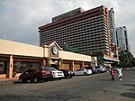
Remedios Circle and Malate Bayview Mansion

Remedios Circle, also known as the Plaza de la Virgen de los Remedios, Remedios Rotonda, and Rotary Circle, is a traffic circle in Malate, Manila in the Philippines, serving as the intersection between Remedios Street, Jorge Bocobo Street and Adriatico Street. The circle and a traversing street are both named after Nuestra Señora de los Remedios (Our Lady of Remedies), the patroness of the nearby Malate Church, and is one of two major open spaces in Malate, the other being Plaza Rajah Sulayman. Originally a cemetery in colonial times, the circle is known today for being the center of Manila's nightlife, as well as a popular cruising spot for men who have sex with men.

Excerpt from the Wikipedia article Remedios Circle (License: CC BY-SA 3.0, Authors, Images).

Remedios Circle
Remedios Circle, Manila Malate (Fifth District)

Geographical coordinates (GPS) Address Nearby Places
placeShow on map

Wikipedia: Remedios CircleContinue reading on Wikipedia

Geographical coordinates (GPS)

Latitude Longitude
N 14.570369444444 ° E 120.98655 °
placeShow on map

Address

Remedios Circle
1004 Manila, Malate (Fifth District)
Philippines
mapOpen on Google Maps

Remedios Circle and Malate Bayview Mansion
Share experience

Nearby Places

Roxas Boulevard
Roxas Boulevard

Roxas Boulevard is a popular waterfront promenade in Metro Manila in the Philippines. The boulevard, which runs along the shores of Manila Bay, is well known for its sunsets and stretch of coconut trees. The divided roadway has become a trademark of Philippine tourism, famed for its yacht club, hotels, restaurants, commercial buildings and parks. The boulevard was completed in the 1910s. Originally called Cavite Boulevard, it was renamed Dewey Boulevard in honor of the American admiral George Dewey, whose forces defeated the Spanish navy in the Battle of Manila Bay in 1898, Heiwa Boulevard in late 1941 during the Japanese occupation, and finally Roxas Boulevard in the 1960s in honor of President Manuel Roxas, the fifth president of the Philippines. It was also designated as a new alignment of the Manila South Road that connects Manila to the southern provinces of Luzon.The boulevard is also an eight-lane major arterial road in Metro Manila designated as Radial Road 1 (R-1) of Manila's arterial road network, National Route 61 (N61), the shortest primary route in the Philippines, National Route 120 (N120) of the Philippine highway network and a spur of Asian Highway 26 (AH26). The arcing road runs in a north–south direction from Luneta in Manila and ends in Parañaque at the intersection of MIA Road and Seaside Drive, beneath the elevated NAIA Expressway. Beyond its southern terminus, starts the Manila–Cavite Expressway (E3), also known as the Coastal Road, or more recently, CAVITEX.