place

Bel Air Racetrack

1962 disestablishments in MarylandDefunct horse racing venues in the United StatesHorse racing venue stubsMaryland building and structure stubsMaryland sport stubs
Southern United States sports venue stubs

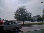
Bel Air Racetrack was a horse racing facility located one mile north of Baltimore Pike and east of Tollgate Road in Bel Air, Maryland. The 100-acre site was originally plotted in 1870 but was later improved and expanded in 1936 by new owner Ray Bryson to include a 3/4-mile race track, new starting gate, and larger grandstands. The track flourished until the 1940s when the owners became embroiled in political efforts to close the track.After Bryson died in 1958, the state legislature eventually prevailed and the track closed in 1962. The property is now the site of Harford Mall.

Excerpt from the Wikipedia article Bel Air Racetrack (License: CC BY-SA 3.0, Authors).

Bel Air Racetrack
Vietnam Veterans Memorial Highway, Bel Air

Geographical coordinates (GPS) Address Nearby Places
placeShow on map

Wikipedia: Bel Air RacetrackContinue reading on Wikipedia

Geographical coordinates (GPS)

Latitude Longitude
N 39.525703 ° E -76.356702 °
placeShow on map

Address

Harford Mall

Vietnam Veterans Memorial Highway
21014 Bel Air
Maryland, United States
mapOpen on Google Maps

Share experience

Nearby Places

Ma and Pa Trail

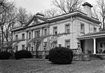
The Ma and Pa Trail is a 6.25-mile (10.1 km) multi-purpose rail trail that follows the path of the old Ma and Pa Railroad through Harford County, Maryland. It contains three linked trails, one unconnected, with plans to bridge the gap in the middle, bringing the total length to 10 miles (16 km). Both links of the trail have a variety of trail surfaces (paved, larger gravel, finer gravel), have few steep hills or hazards, and contain overlooks and bridges when necessary. The Bel Air Trail is a 2.5-mile (4.0 km) trail that runs from Williams Street in downtown to the Equestrian Center on the other side of the bypass. It passes underneath of the Maryland Route 24 (MD 24) highway, the U.S. Route 1 (US 1) bypass, and crosses Tollgate Road, where it meets the Fallston Trail. Spurs off of it connect to the Harford Mall and Liriodendron mansion, and branches out to a dog park at the end. It serves as a shortcut across town, rather than walking along highways, and contains several bridges across branches of the creek while cutting through the forested Heavenly Waters Park. Bathrooms and parking are available at each end of the trail. Horses and dogs are permitted on the Bel Air link of the path. The Fallston Link is a 2-mile (3.2 km) segment dedicated on June 7, 2008, that runs from the Equestrian Center to the Edgeley Grove Farm area of Fallston.The Forest Hill Trail is a third, 1.75-mile (2.8 km) link of the trail running from the duckpond at Friends Park to Melrose Lane. A tunnel is located at MD 23, but passes over a development street on the north end. Bathrooms and parking are located at each end. Dogs are allowed on the Forest Hill link, but horses are not. As of late 2020, final preparations for construction to link the two routes into one continuous trail is underway. At the time of the original constructions, a tunnel was built underneath of US 1 in preparation, but it is unconnected to any path system. Construction for an extension from Bel Air to the Edgeley Grove area in Fallston is planned, and a 4.1-mile (6.6 km) northern link at Dooley Road, near the state line in Cardiff is under study.