place

Northfield, Staten Island

Former towns in New York CityGeography of Staten IslandHistory of Staten IslandStaten Island geography stubs
Richmond County (Staten Island) cropped from Richmond Queens Kings counties map by David Burr 1839

Northfield was a town in Richmond County, New York. It was incorporated in 1788 as one of the four original towns of Staten Island. It was dissolved in 1898 upon consolidation into the City of New York.

Excerpt from the Wikipedia article Northfield, Staten Island (License: CC BY-SA 3.0, Authors, Images).

Northfield, Staten Island
Richmond Avenue, New York Staten Island

Geographical coordinates (GPS) Address Nearby Places
placeShow on map

Wikipedia: Northfield, Staten IslandContinue reading on Wikipedia

Geographical coordinates (GPS)

Latitude Longitude
N 40.597222222222 ° E -74.161111111111 °
placeShow on map

Address

Richmond Avenue 2075
10314 New York, Staten Island
New York, United States
mapOpen on Google Maps

Richmond County (Staten Island) cropped from Richmond Queens Kings counties map by David Burr 1839
Share experience

Nearby Places

Bulls Head, Staten Island

Bulls Head is a neighborhood in west-central Staten Island, one of the five boroughs of New York City. It is bordered by New Springville to the south, Bloomfield to the west, Willowbrook to the east, Graniteville to the north, and Westerleigh to the north. The community received its name from an 18th-century tavern located at the intersection of Victory Boulevard and Richmond Avenue (the neighborhood's central point), from which a sign bearing a bull's head was displayed. The Bulls Head area was also known as Phoenixville. During the American Revolution, this tavern became the local headquarters of the faction loyal to the British crown, or Tories, as they were colloquially known. As recently as the early 1960s, Bulls Head and the surrounding neighborhoods, such as Willowbrook to the east and Graniteville to the north, were dominated by farmland. Dramatic change came soon after the Verrazano-Narrows Bridge opened in 1964, opening up the area to residential development. Soon many Jewish families, mostly from the boroughs of Brooklyn and Queens, settled in Bulls Head and other west mid-island neighborhoods. A smaller number of Asian immigrants live in Bulls Head. Many of the residents are Italian Catholics served by Our Lady of Pity R.C. Church.Bulls Head's schools are the elementary school P.S. 60 and the intermediate school I.S. 72. Most of the residents are zoned for Port Richmond High School. The Todt Hill Library is nearby, at 2550 Victory Boulevard. Bulls Head is served by the S44, S59, S62, S89, S92 and S94 local buses and the SIM4, SIM4C, SIM8, SIM8X, SIM32 and SIM33 express buses.As of the 2010 census, the demographics of Bulls Head were roughly 71.2% White, 2.3% Black, 15% Hispanic, 9.8% Asian, and 1.7% Other. This is defining Bulls Head as everything within the boundaries of Census Tracts 291.03, and 291.04, as well as the blocks north of Willowbrook Park in Tract 273.01.

William T. Davis Wildlife Refuge

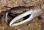
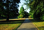
The William T. Davis Wildlife Refuge (WTDWR) is an 814-acre (3.29 km2) wildlife refuge straddling the New Springville and Travis sections of Staten Island. The park was named in honor of Staten Island native William T. Davis, a renowned naturalist and entomologist who along with the Audubon Society started the refuge with an original acquisition of 52 acres (210,000 m2). Additional acreage was acquired in increments and the park is today 814 acres (3.29 km2). Beginning in 2010, the adjacent 223-acre (0.90 km2) North Park section of Freshkills Park (the redevelopment of the Fresh Kills Landfill) has undergone preparation to serve as an expansion of the wildlife refuge. This refuge is the sixth largest park in New York City out of a total of 1,700 parks; it is only 30 acres (120,000 m2) smaller than Central Park. The United for Wildlife Rehabilitation and Education Center is located at the William T. Davis Wildlife Refuge near the intersection of Travis and Richmond Avenues. The center seeks “to care for sick, injured and orphaned wildlife and return them to the wild.” The center is sponsored by the New York City Parks Department and serves as a holding facility for the New York State Department of Environmental Conservation. Injured animals convalesce at the facility and are eventually returned to the wild. The refuge is at the confluence of Main and Springville Creeks, two tributaries of Freshkill Creek, a tidal creek which is connected to the Arthur Kill. Within the refuge there are expansive salt marshes with low marsh bordering the creeks and flooding twice daily with the high tide and a more expansive area of high marsh which floods occasionally during exceptionally high tide. In the low marsh, saltmarsh cordgrass (Spartina alterniflora) is the dominant species while saltmeadow cordgrass (Spartina patens) is found in the high marsh. There are degraded areas of the marsh in which the common reed (Phragmites australis), an invasive species, has supplanted the native cordgrass; this generally occurs in the high marsh zone where the soil is saturated but infrequently inundated. In addition to the salt marshes there are forested uplands and a swamp forest and small spring-fed ponds. Marine life: The marine life present in the refuge includes the fiddler crab (Uca pugnax), ribbed mussel (Geukensia demissa), clam and oyster. Bird species: Over 117 bird species have been recorded at the William T. Davis Wildlife Refuge, including sharp-tailed sparrow (Ammodramus caudacutus), and wood duck (Aix sponsa). Among the species of raptors which frequent the park are red-tailed hawks (Buteo jamaicensis) red-shouldered (Buteo lineatus), and rough-legged (Buteo lagopus) hawks and osprey. There are also various species of owl such as Barn (Tyto alba), great horned (Bubo virginianus), and short-eared (Asio flammeus). The Great blue heron hunts fish along the tidal marshes. Mammals: Muskrats (Ondatra zibethica) live along the marshes; there are also raccoons, eastern grey squirrel, chipmunk, and a few species of field mouse.In addition to the invasive common reed, some sections of the refuge especially along Travis Ave. are overrun by Japanese knotweed. The fresh-water New Springville Creek, which originates in the Greenbelt, flows into the park. The creek is subterranean for most of its length, having been enclosed in pipe.In the east of the refuge was the burial site for six people murdered and dismembered by the Bonanno crime family associate Thomas "Tommy Karate" Pitera, who was sentenced to life in prison in 1992.