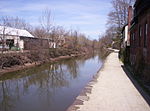
Six Mile Run Reservoir Site

The Six Mile Run Reservoir Site, part of the Delaware and Raritan Canal State Park, is located in Franklin Township, Somerset County, New Jersey, United States. It is adjacent to the Delaware and Raritan Canal. It covers 3,037 acres (12.29 km2). The reservoir plan was to flood the Six Mile Run watershed. The Six Mile Run is a tributary of the Millstone River that, with its tributaries (Cross Brook, Middlebush Brook, Nine Mile Run and Steep Hill Brook and several other unnamed ones), drains a large area in central Franklin Township, Somerset County, New Jersey and western portions of North Brunswick and South Brunswick Townships in Middlesex County, New Jersey. It derives its name, along with other streams (Mile Run, Three Mile Run, Nine Mile Run, and Ten Mile Run), from the distance early surveyors estimated it was from the point where the historic King's Highway (now Rt. 27) left the Raritan River at New Brunswick to the point the roadway crossed the stream. The estimates were not very accurate but the stream names have remained in use ever since.
Excerpt from the Wikipedia article Six Mile Run Reservoir Site (License: CC BY-SA 3.0, Authors, Images).Six Mile Run Reservoir Site
Blue Trail,
Geographical coordinates (GPS) Address Nearby Places Show on map
Geographical coordinates (GPS)
| Latitude | Longitude |
|---|---|
| N 40.475207 ° | E -74.566569 ° |
Address
Blue Trail
Blue Trail
08823
New Jersey, United States
Open on Google Maps


