Brand (Aachen)
Aachen
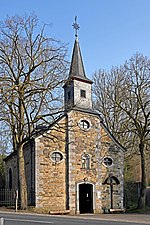
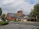
Brand is a borough of Aachen, Germany, with about 18,000 residents. The borough lies in the south-east part of Aachen and borders Kornelimünster/Walheim, Forst, Oberforstbach und Eilendorf, as well as the town of Stolberg. Brand was a self-administered community in the district of Aachen until 1972, when administrative reforms of the communities in the area caused Brand to be absorbed into Aachen. The current borough of Brand is made up of the towns Brand, Freund, Krauthausen, Niederforstbach, Brander Feld and Rollef. At 270.9 meters, the highest point of the borough is a noise barrier along the Bundesautobahn 44, which runs through Brand Forest.
Excerpt from the Wikipedia article Brand (Aachen) (License: CC BY-SA 3.0, Authors).Brand (Aachen)
Trierer Straße, Aachen Freund
Geographical coordinates (GPS) Address Nearby Places Show on map
Geographical coordinates (GPS)
| Latitude | Longitude |
|---|---|
| N 50.748888888889 ° | E 6.165 ° |
Address
Trierer Straße 794
52078 Aachen, Freund
North Rhine-Westphalia, Germany
Open on Google Maps


