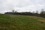
Fleet Marston

Fleet Marston is a civil parish and deserted medieval village in the Aylesbury Vale district of Buckinghamshire, England, about 2.5 miles (4 km) northwest of the centre of Aylesbury. The parish measures about 2.5 miles (4 km) north – south, but east – west it is nowhere more than about 3⁄4 mile (1.2 km) wide. It is bounded to the southeast by the River Thame, to the east by a stream that joins the Thame, and to the west by field boundaries. It has an area of 934 acres (378 ha).The A41 main road between Aylesbury and Waddesdon runs through the middle of the parish. Aylesbury Vale Parkway railway station is on the A41 road, just outside the parish's eastern boundary. In 2010 the Office for National Statistics estimated the parish population to be 47. The 2011 Census included its population in that of the civil parish of Waddesdon.In 2022 HS2 archaeologists discovered a Roman cemetery, and exhumed about 425 bodies including 40 decapitated skeletons. 1,200 coins were also discovered.
Excerpt from the Wikipedia article Fleet Marston (License: CC BY-SA 3.0, Authors, Images).Fleet Marston
A41,
Geographical coordinates (GPS) Address Nearby Places Show on map
Geographical coordinates (GPS)
| Latitude | Longitude |
|---|---|
| N 51.842 ° | E -0.876 ° |
Address
A41
HP18 0PX
England, United Kingdom
Open on Google Maps


