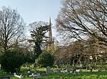
Longford River

The Longford River is an artificial waterway, a distributary designed to embellish a park, that diverts water 12 miles (19 km) from the River Colne at Longford near Colnbrook in England, to Bushy Park and Hampton Court Palace. Its main outlet is to the reach above Molesey Lock with lesser pond outlet channels to that above Teddington Lock (of the Thames). The waterway was built for King Charles I in 1638/39 as a water supply for Hampton Court. Water features in Bushy Park were added in 1710. North of the A30, its course has been diverted more than once as London Heathrow Airport has grown. Its cascades, grassed banks and fountains in Bushy Park were restored and reopened to the public in 2009 to close to their original state.
Excerpt from the Wikipedia article Longford River (License: CC BY-SA 3.0, Authors, Images).Longford River
Cobblers Walk, London Hampton Hill (London Borough of Richmond upon Thames)
Geographical coordinates (GPS) Address Nearby Places Show on map
Geographical coordinates (GPS)
| Latitude | Longitude |
|---|---|
| N 51.419444444444 ° | E -0.3525 ° |
Address
Cobblers Walk
Cobblers Walk
TW12 2SR London, Hampton Hill (London Borough of Richmond upon Thames)
England, United Kingdom
Open on Google Maps


