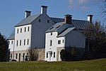
Battle of Tom's Brook
The Battle of Tom's Brook was fought on October 9, 1864, in Shenandoah County, Virginia, during Philip Sheridan's Shenandoah Valley Campaign of the American Civil War. It resulted in a significant Union victory, one that was mockingly dubbed The Woodstock Races for the speed of the Confederate withdrawal.After his victory at Fisher's Hill, Maj. Gen. Philip Sheridan pursued Jubal A. Early's Confederate army up the Shenandoah Valley to near Staunton. On October 6, Sheridan began withdrawing, as his cavalry burned everything that could be deemed of military significance, including barns and mills. Reinforced by Maj. Gen. Joseph B. Kershaw's division, Early followed. Maj. Gen. Thomas L. Rosser arrived from Petersburg to take command of Maj. Gen. Fitzhugh Lee's Confederate cavalry division and harassed the retreating Federals. On October 9, Brig. Gen. Alfred Torbert's Union troopers turned on their pursuers, routing the divisions of Rosser, whose cavalrymen were repulsed by Custer in a flanking maneuver along the base of Spiker's Hill off of Back Road, and Lunsford L. Lomax, who was positioned in the vicinity of the Valley Pike, at Tom's Brook. With this victory, the Union cavalry attained overwhelming superiority in the Valley. That's General Custer, the Yanks are so proud of, and I intend to give him the best whipping today that he ever got, Jubal Early later commented sourly about Rosser's Laurel Brigade, "The laurel is a running vine".
Excerpt from the Wikipedia article Battle of Tom's Brook (License: CC BY-SA 3.0, Authors).Battle of Tom's Brook
Old Valley Pike,
Geographical coordinates (GPS) Address Nearby Places Show on map
Geographical coordinates (GPS)
| Latitude | Longitude |
|---|---|
| N 38.9429 ° | E -78.4458 ° |
Address
Old Valley Pike 26245
22660
Virginia, United States
Open on Google Maps


