place

Monte Vista (Middletown, Virginia)

Frederick County, Virginia geography stubsHouses completed in 1883Houses in Frederick County, VirginiaHouses on the National Register of Historic Places in VirginiaNational Register of Historic Places in Frederick County, Virginia
Queen Anne architecture in VirginiaShenandoah Valley, Virginia Registered Historic Place stubs
Monte Vista Middletown

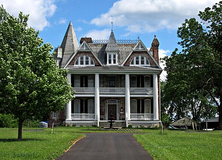
Monte Vista, also known as Cedar Grove Farm and Heater House, is a historic home located near Middletown, Frederick County, Virginia. It was built in 1883, and is a large three-story, five-bay, brick dwelling with Eastlake and Queen Anne design elements. The front facade features a two-story portico with four full-height Tuscan columns, added about 1942. Also on the property are the contributing large bank barn with cupola and weathervane, a scale house dating at least to 1907, a frame summer kitchen, a two level stone ice house, a smokehouse, and a brick bake oven. It was owned by Solomon and Caroline Wunder Heater, who lost two sons fighting for the Confederacy, even though she was a staunch Union sympathizer.It was listed on the National Register of Historic Places in 1987.

Excerpt from the Wikipedia article Monte Vista (Middletown, Virginia) (License: CC BY-SA 3.0, Authors, Images).

Monte Vista (Middletown, Virginia)
I 81,

Geographical coordinates (GPS) Address Nearby Places
placeShow on map

Wikipedia: Monte Vista (Middletown, Virginia)Continue reading on Wikipedia

Geographical coordinates (GPS)

Latitude Longitude
N 39.02 ° E -78.289444444444 °
placeShow on map

Address

Stowe-Woodward

I 81
22645
Virginia, United States
mapOpen on Google Maps

Monte Vista Middletown
Share experience

Nearby Places

Middletown Historic District (Middletown, Virginia)

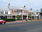
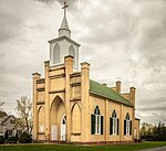
The Middletown Historic District is a national historic district located in Middletown, Virginia. It originally encompassed 234 contributing properties, the majority of which are residential buildings and their associated outbuildings. The boundaries of the historic district are approximately Church Street, Senseney Avenue, and First through Sixth Streets, except for a portion of Main Street that ends just south of Reliance Road (Route 627). The non-residential historic structures include four specialty shops, a former theater, four churches, the Town Hall, two former schools, three warehouses and an inn. Notable buildings include the former Middletown Mission Church (c. 1818), Grace United Methodist Church (1897), the former Mt. Zion Church (1880), the former Middletown School (1909), the Town Hall (1880), the Wayside Inn (1797), Larrick's Tavern (1750), the former Wayside Theatre (1946), and Lafolette House (1800). Located in the district and separately listed on the National Register of Historic Places (NRHP) and Virginia Landmarks Register (VLR) is St. Thomas Chapel (1837). The area that is present-day Middletown began developing in the mid-18th century due to the Great Wagon Road that brought settlers and commerce to the Shenandoah Valley. When the Virginia General Assembly formally established Middletown in 1796, there were already many residential and commercial buildings in the area. The town continued to develop thanks to the Valley Turnpike, present-day Main Street/U.S. Route 11, which connected the town to nearby Newtown (Stephens City) and Strasburg. During the 19th century Middletown experienced continued residential and commercial growth until the Civil War. Many skirmishes took place in the area during Jackson's Valley campaign. The 1864 Battle of Cedar Creek, which began just south of the town limits before moving north through the town, resulted in many damaged properties. Commerce increased after a railroad track built in 1870 helped the town recover from the war's effects. Many of the town's historic houses were constructed in the late-19th century. In the 20th century Route 11 was widened, utilities were installed, and the county's first high school opened in Middletown. Additional houses, warehouses, and commercial buildings, including a bank and movie theater, were constructed. A fire station built in the 1960s replaced historic houses, a trend that continued during the next few decades. Due to the efforts of a local heritage group and with support from residents, a large portion of the town was listed as a historic district by the VLR and NRHP in 2003. Despite the historic designation, there have been several contributing properties demolished. Town officials are hoping to avoid further demolition by encouraging residents to maintain their property and by preventing the construction of buildings that do not fit in with the character of the historic district.
Battle of Cedar Creek

The Battle of Cedar Creek, or Battle of Belle Grove, was fought on October 19, 1864, during the American Civil War. The fighting took place in the Shenandoah Valley of Northern Virginia, near Cedar Creek, Middletown, and the Valley Pike. During the morning, Lieutenant General Jubal Early appeared to have a victory for his Confederate army, as he captured over 1,000 prisoners and over 20 artillery pieces while forcing 7 enemy infantry divisions to fall back. The Union army, led by Major General Philip Sheridan, rallied in late afternoon and drove away Early's men. In addition to recapturing all of their own artillery seized in the morning, Sheridan's forces captured most of Early's artillery and wagons. In heavy fog, Early attacked before dawn and completely surprised many of the sleeping Union soldiers. His smaller army attacked segments of the Union army from multiple sides, giving him temporary numerical advantages in addition to the element of surprise. At about 10:00 am, Early paused his attack to reorganize his forces. Sheridan, who was returning from a meeting in Washington, D.C. when the battle started, hurried to the battlefield and arrived around 10:30 am. His arrival calmed and revitalized his retreating army. At 4:00 pm his army counterattacked, making use of its superior cavalry force. Early's army was routed and fled south. The battle ruined the Confederate army in the Shenandoah Valley, and it was never again able to maneuver down the valley to threaten the Union capital city of Washington, D.C. or northern states. Additionally, the Shenandoah Valley had been a key producer of supplies for the Confederate army, and Early could no longer protect it. The Union victory aided the reelection of Abraham Lincoln, and along with earlier victories at Winchester and Fisher's Hill, won Sheridan lasting fame.

Belle Grove Plantation (Middletown, Virginia)

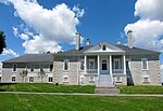
Belle Grove Plantation is a late-18th-century plantation house and estate in the northern Shenandoah Valley of Virginia, USA. It is situated in Frederick County, about a mile southwest of Middletown. Built between 1794 and 1797, the large Federal-style manor house is a National Historic Landmark and was opened to the public by its owners, the National Trust for Historic Preservation (NTHP), as a historic house museum in 1967. In 2002, Belle Grove became part of the Cedar Creek and Belle Grove National Historical Park, a National Park Service unit, although it continues to be owned and operated by the NTHP. It is part of a U.S. National Historic Landmark, the Cedar Creek Battlefield and Belle Grove Plantation. Belle Grove is also designated a Virginia Historic Landmark and, as part of 900-acre (3.6 km2) "Cedar Creek Battlefield and Belle Grove", is listed on the National Register of Historic Places. Historically important as the home of revolutionary veteran Major Isaac Hite, Jr – President James Madison’s brother-in-law – and as the headquarters of General Philip Sheridan during the Battle of Cedar Creek (1864), the manor house has been little altered over the centuries and remains one of the best preserved 18th century homes in the country. Affording grand vistas of the surrounding Shenandoah Valley, Blue Ridge and Alleghenies, the estate is situated on 283 acres of Maj. Hite’s original 483 acres. (The entire CCBGNHP, including the nearby battlefield, consists of 3,593 acres.)

Shenandoah Valley AVA

The Shenandoah Valley AVA is an American Viticultural Area located in the Shenandoah Valley of Virginia and West Virginia. The valley is bounded by the Blue Ridge Mountains to the east and the Appalachian and Allegheny Plateaus to the west. Most of the AVA is in Virginia, with a small portion in the Eastern Panhandle of West Virginia. Most of the vineyards in the AVA are located in Virginia and grow a wide variety of Vitis vinifera, Vitis labrusca, and French hybrid grapes. The hardiness zone is mainly 7a except for some 6b in high areas. The region is Virginia's first AVA, identified in 1982. Limestone soil, which is common to the Valley, has been long associated with great wine growing regions in Europe. The Shenandoah Valley AVA's climate allows grapes to attain higher acidity, generally regarded as good in wine. The cooler, relatively dry climate, soil composition and position between two mountain chains makes the Shenandoah Valley more ideal for viticulture than any of the state's other regions. The Shenandoah Valley is relatively dry, a "rain shadow" between the Blue Ridge and Allegheny Mountains; the annual rainfall in the Valley is one half that of the Virginia average. The growing season in the valley is distinctly warmer and drier than in neighboring Virginia regions, which don't have the natural rain barrier from the nearby mountains and where, east of the Blue Ridge, vineyard soils are primarily clay and loam. The conditions in the Shenandoah Valley AVA are thus more hospitable than those east of the mountains for Cabernet Franc, Chambourcin, Cabernet Sauvignon, Lemberger, Petit Manseng, Petit Verdot, Pinot Noir, and Riesling.