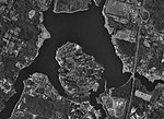
Conspiracy Island
Conspiracy Island is a privately owned tidal island situated in the Assonet River off Berkley, Massachusetts. According to the 2000 census, Conspiracy Island is uninhabited. In very low tides, the island is actually a peninsula, accessible across a sandy stretch of land connecting it to a nearby beach. A Gazetteer of the State of Massachusetts, published in 1890, describes the history of localities in Massachusetts. In its listing for Berkley, the book states that the island may have received its name from its connection to King Philip, himself the namesake of King Philip's War. Berkley's history also includes a legend that in 1675 on Conspiracy Island King Phillip formed his confederacy.
Excerpt from the Wikipedia article Conspiracy Island (License: CC BY-SA 3.0, Authors).Conspiracy Island
Riverside Drive,
Geographical coordinates (GPS) Address Nearby Places Show on map
Geographical coordinates (GPS)
| Latitude | Longitude |
|---|---|
| N 41.783311111111 ° | E -71.115275 ° |
Address
Riverside Drive 6
02702
Massachusetts, United States
Open on Google Maps


