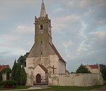
Eastern Neisse

The Eastern Neisse, also known by its Polish name of Nysa Kłodzka (German: Glatzer Neiße, Czech: Kladská Nisa), is a river in southwestern Poland, a left tributary of the Oder, with a length of 188 km (21st longest) and a basin area of 4,570 km2 (3,742 in Poland).Prior to World War II it was part of Germany. During the Yalta Conference it was discussed by the Western Allies as one possible line of the western Polish border. Attempts were made to negotiate a compromise with the Soviets on the new Polish-German frontier; it was suggested that the Eastern Neisse be made the line of demarcation. This would have meant that (East) Germany could have retained approximately half of Silesia, including most of Wrocław (formerly Breslau). However the Soviets rejected the suggestion at the Potsdam Conference and insisted that the southern boundary between Germany and Poland be drawn further west, at the Lusatian Neisse. in some way reintroducing the border to the place from the beginnings of Polish statehood, i.e. west of Legnica Town, important for Bolesław IV the Curly and Henry the Bearded, two Polish Princepses.
Excerpt from the Wikipedia article Eastern Neisse (License: CC BY-SA 3.0, Authors, Images).Eastern Neisse
gmina Popielów
Geographical coordinates (GPS) Address Nearby Places Show on map
Geographical coordinates (GPS)
| Latitude | Longitude |
|---|---|
| N 50.819166666667 ° | E 17.658333333333 ° |
Address
gmina Popielów
Opole Voivodeship, Poland
Open on Google Maps


