Gazeley
Civil parishes in SuffolkForest HeathGazeleyVillages in Suffolk

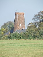
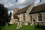
Gazeley is a village and civil parish in the West Suffolk district of Suffolk in eastern England and is part of the West Suffolk UK Parliament constituency. In 2005 it had a population of 740. A house converted from a windmill survives in the village. The surnames of Gazeley, Gazley and Gazlay derive from this source. The name Gazeley means "Woodland clearing of a man called *Gǣgi".The Icknield Way Path passes through the village on its 110-mile journey from Ivinghoe Beacon in Buckinghamshire to Knettishall Heath in Suffolk. The Icknield Way Trail, a multi-user route for walkers, horse riders and off-road cyclists also passes through the village.
Excerpt from the Wikipedia article Gazeley (License: CC BY-SA 3.0, Authors, Images).Gazeley
Carpenters Close, West Suffolk
Geographical coordinates (GPS) Address Nearby Places Show on map
Geographical coordinates (GPS)
| Latitude | Longitude |
|---|---|
| N 52.247904 ° | E 0.518245 ° |
Address
Carpenters Close
Carpenters Close
CB8 8GE West Suffolk
England, United Kingdom
Open on Google Maps


