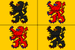
The County of Hainaut (French: Comté de Hainaut; Dutch: Graafschap Henegouwen; Latin: comitatus hanoniensis), sometimes spelled Hainault, was a territorial lordship within the medieval Holy Roman Empire that straddled the present-day border of Belgium and France. Its most important towns included Mons (Dutch: Bergen), now in Belgium, and Valenciennes, now in France.
The core of the county, named after the river Haine, stretched southeast to include the Avesnois region and southwest to the Selle (Scheldt tributary). In the Middle Ages, its Counts also gained control of part of the original pagus of Brabant to its north and the pagus of Oosterbant to the east, but they did not form part of the old pagus of Hainaut. In modern terms, the original core of Hainaut consisted of the central part of the Belgian province of Hainaut, and the eastern part of the French département of Nord (the arrondissements of Avesnes-sur-Helpe and Valenciennes).
Hainaut appears in 8th-century CE records as a Frankish gau or pagus which included the Roman towns of Famars and Bavay. In the 9th century, if not earlier, it was also described as a county, which implies that it had a single count governing it. As with many counties of the region, there was apparently a 10th-century fragmentation of territories among different counts, which is difficult to reconstruct. In 1071 a single large territorial county was given its more-or-less final form that lasted for the rest of the Middle Ages.
For much of its existence the County of Hainaut was a frontier territory, bordering upon the Kingdom of France. From 843 the County formed part of the "middle kingdom" of Lotharingia. After about 925 Lotharingia was definitively attached by King Henry the Fowler to his eastern Frankish realm that would become the Kingdom of Germany. Hainaut and its neighbourhood remained an important frontier area, or "march", during the High Middle Ages. Though a part of the Holy Roman Empire, ruled from present-day Germany, it was culturally and linguistically French and ecclesiastically part of the Catholic Archdiocese of Reims. Like its neighbours such as the counties of Brabant and Flanders, it frequently became entangled in the politics of France.
The counts of Hainaut were often rulers of other counties, including Flanders and Holland. Examples of such personal unions include the following:
Hainaut and Flanders: 1067–71 and again 1191–1246
Hainaut, Holland and Zeeland: 1299–1356
Hainaut, Holland and Zeeland as part of Bavaria-Straubing: 1356–1432In 1432, Hainaut, Holland and Zeeland joined Flanders, Artois, Namur, Brabant, Limbourg, and later Luxembourg, within the large agglomeration of territories in the Low Countries belonging to the French House of Valois-Burgundy. This new state, the Burgundian Netherlands, was inherited by the Habsburg dynasty in the 1470s.
In 1659 and 1678 southern Hainaut was acquired by France. The northern part continued as part of the Habsburg Netherlands. Like much of that state, the northern part of Hainaut was absorbed into the First French Republic in 1797 after the end of the Ancien Régime; it later became part of newly-formed Belgium in 1830.


