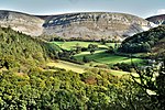
Cyffylliog
Clwyd geography stubsVillages in Denbighshire

Cyffylliog (also Y Gyffylliog in Welsh) is a village and community in Denbighshire, Wales. It is situated to the west of Ruthin on the banks of the River Clywedog. The community covers an area of 31.59 km2 and includes the hamlet of Bontuchel and a section of Clocaenog Forest. It had a population of 495 at the time of the 2011 census, a slight increase from 484 during the 2001 census. The name of the village means "place of pollard trees/stumps" and comes from the Welsh word cyffyll meaning stumps.The village has a small, bilingual primary school, Ysgol Cyffylliog, which had 25 pupils in 2011.
Excerpt from the Wikipedia article Cyffylliog (License: CC BY-SA 3.0, Authors, Images).Cyffylliog
Maes y Delyn,
Geographical coordinates (GPS) Address Nearby Places Show on map
Geographical coordinates (GPS)
| Latitude | Longitude |
|---|---|
| N 53.108 ° | E -3.406 ° |
Address
Maes y Delyn
LL15 2DX , Cyffylliog
Wales, United Kingdom
Open on Google Maps


