place

Furggen

Alpine three-thousandersAosta Valley geography stubsInternational mountains of EuropeItaly mountain stubsItaly–Switzerland border
Mountains of Aosta ValleyMountains of SwitzerlandMountains of ValaisMountains of the AlpsValais mountain stubs
Furgenn 003
Furgenn 003

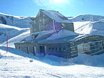
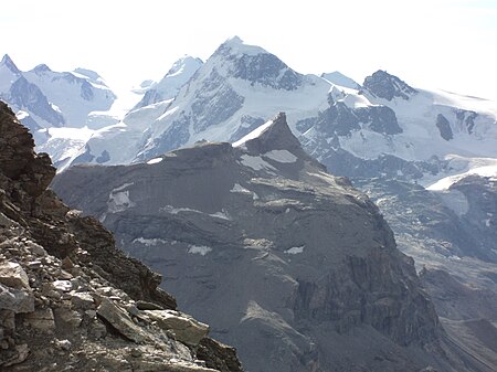
The Furggen (3,492 m) is a mountain of the Pennine Alps, located on the border between Italy (Aosta Valley) and Switzerland (Valais). It is the culminating point of the ridge named Furgggrat stretching from the Furggjoch (3,271 m) to the Theodul Pass (3,295 m), and is located halfway between the Matterhorn and Testa Grigia. The peak is the site of the now abandoned cable car station. Construction on the cable car began in the summer of 1950 - with the station on the Furggen summit designed by Carlo Mollino - and the lift opened to the public on 25 December 1952. The lift had a single span of 2,887m long - making it the world's longest at the time of its opening. The car could hold 25 passengers and transport 240 people per hour. The lift between Plan Maison and Furggen was designed as part of a system of cable cars reaching from Breuil-Cervinia to the Matterhorn, with leg one running from Breuil-Cervinia to Plan Maison (opened on 4 March 1939). Leg 2 running from Plan Maison up to the summit of Furggen, and leg 3 reaching the top of the Matterhorn. The final leg was never constructed, partly as a result of the large cost and due to environmental opposition. The leg between Plan Maison and Furggen was abandoned in 1993 after ice brought down the cables and they were never replaced. The station on the summit of Furggen is now abandoned, but the leg between Breuil-Cervinia and Plan Maison is still in place.

Excerpt from the Wikipedia article Furggen (License: CC BY-SA 3.0, Authors, Images).

Furggen
Galleria Funivia Furggen,

Geographical coordinates (GPS) Address Nearby Places
placeShow on map

Wikipedia: FurggenContinue reading on Wikipedia

Geographical coordinates (GPS)

Latitude Longitude
N 45.956944444444 ° E 7.6813888888889 °
placeShow on map

Address

Funivia del Furggen

Galleria Funivia Furggen

Aosta Valley, Italy
mapOpen on Google Maps

Furgenn 003
Furgenn 003
Share experience

Nearby Places

Hörnli Hut
Hörnli Hut

The Hörnli Hut (German: Hörnlihütte) is a mountain hut located at the foot of the north-eastern ridge (Hörnli Ridge) of the Matterhorn. It is situated at 3,260 metres (10,700 ft) above sea level, a few kilometres south-west of the town of Zermatt in the canton of Valais in Switzerland. It is also known as Berghaus Matterhorn. The first Hörnli hut was built by the Swiss Alpine Club in 1880 and had 17 beds. It has since been expanded and rebuilt several times. In 1911, the municipality of Zermatt built a hut directly next to the Hotel Belvédère (also Berghaus Matterhorn). Both were merged in 1987 and managed by the municipality and offered since its last renovation in 1982 a number of 170 beds. From 2013 to 2015, the Belvédère was renovated and a new extension built. The original Hörnli hut was demolished. The new hut was inaugurated on 14 July 2015, the 150th anniversary of the first ascent of the mountain. It offers 130 beds (in a total of 34 8-,6-,4- and 2-person rooms) and an enlarged kitchen, modernized sanitation with showers and electricity from solar energy. Camping around the hut is prohibited and there is a winter room with limited provisions. Overcrowding on the several routes have become an issue and guides and local authorities have struggled with how to regulate the numbers. The new Hörnli hut became the first mountain shelter in Europe to purposely limit the number of beds.The hut is accessible to hikers. From the cable car station of Schwarzsee (or from Zermatt) a marked trail leads to the ridge and then to the hut. It is used to climb the Matterhorn on the normal route. The Solvay Hut lies also higher on the same ridge, but can be only used in case of emergency.

Matterhorn
Matterhorn

The Matterhorn (, German: [ˈmatɐˌhɔʁn]; Italian: Cervino, [tʃerˈviːno]; French: Cervin, [sɛʁvɛ̃]; Romansh: Mont(e) Cervin(u)) is a mountain of the Alps, straddling the main watershed and border between Switzerland and Italy. It is a large, near-symmetric pyramidal peak in the extended Monte Rosa area of the Pennine Alps, whose summit is 4,478 metres (14,692 ft) high, making it one of the highest summits in the Alps and Europe. The four steep faces, rising above the surrounding glaciers, face the four compass points and are split by the Hörnli, Furggen, Leone/Lion, and Zmutt ridges. The mountain overlooks the Swiss town of Zermatt, in the canton of Valais, to the northeast; and the Italian town of Breuil-Cervinia in the Aosta Valley to the south. Just east of the Matterhorn is Theodul Pass, the main passage between the two valleys on its north and south sides, which has been a trade route since the Roman Era. The Matterhorn was studied by Horace-Bénédict de Saussure in the late eighteenth century, and was followed by other renowned naturalists and artists, such as John Ruskin, in the 19th century. It remained unclimbed after most of the other great Alpine peaks had been attained and became the subject of an international competition for the summit. The first ascent of the Matterhorn was in 1865 from Zermatt by a party led by Edward Whymper, but during the descent, a sudden fall claimed the lives of four of the seven climbers. This disaster, later portrayed in several films, marked the end of the golden age of alpinism. The north face was not climbed until 1931 and is among the three biggest north faces of the Alps, known as "The Trilogy". The west face, the highest of the Matterhorn's four faces, was completely climbed only in 1962. It is estimated that over 500 alpinists have died on the Matterhorn, making it one of the deadliest peaks in the world.The Matterhorn is mainly composed of gneisses (originally fragments of the African Plate before the Alpine orogeny) from the Dent Blanche nappe, lying over ophiolites and sedimentary rocks of the Penninic nappes. The mountain's current shape is the result of cirque erosion due to multiple glaciers diverging from the peak, such as the Matterhorn Glacier at the base of the north face. Sometimes referred to as the Mountain of Mountains (German: Berg der Berge), it has become an indelible emblem of the Alps in general. Since the end of the 19th century, when railways were built in the area, the mountain has attracted increasing numbers of visitors and climbers. Each year, numerous mountaineers try to climb the Matterhorn from the Hörnli Hut via the northeast Hörnli ridge, the most popular route to the summit. Many trekkers also undertake the 10-day-long circuit around the mountain. The Matterhorn has been part of the Swiss Federal Inventory of Natural Monuments since 1983.