place

Boulevard de la Bastille

12th arrondissement of ParisCanals in FranceGeography of Paris
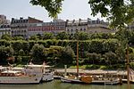
PC130018 Paris XII Boulevard de la Bastille reductwk

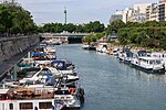
The Boulevard de la Bastille is the southwesternmost street of the 12th arrondissement of Paris, situated in the quartier called Quinze-Vingts. It overlooks the east side of the Paris marina, known as the Port de Plaisance or Port de l'Arsenal, with which it forms a boundary with the 4th arrondissement of Paris. (The Port de l'Arsenal is in fact the terminus of the Canal Saint-Martin, which begins at the Place de Stalingrad.) The boulevard also lies directly north (across the Seine) of the border between the 5th arrondissement and the 13th arrondissement of Paris.

Excerpt from the Wikipedia article Boulevard de la Bastille (License: CC BY-SA 3.0, Authors, Images).

Boulevard de la Bastille
Boulevard de la Bastille, Paris 12th Arrondissement (Paris)

Geographical coordinates (GPS) Address Nearby Places
placeShow on map

Wikipedia: Boulevard de la BastilleContinue reading on Wikipedia

Geographical coordinates (GPS)

Latitude Longitude
N 48.848888888889 ° E 2.3680555555556 °
placeShow on map

Address

Boulevard de la Bastille

Boulevard de la Bastille
75012 Paris, 12th Arrondissement (Paris)
Ile-de-France, France
mapOpen on Google Maps

PC130018 Paris XII Boulevard de la Bastille reductwk
Share experience

Nearby Places

Bassin de l'Arsenal
Bassin de l'Arsenal

The Bassin de l'Arsenal (also known as the Port de l'Arsenal) is a boat basin in Paris. It links the Canal Saint-Martin, which begins at the Place de la Bastille, to the Seine, at the Quai de la Rapée. A component of the Réseau des Canaux Parisiens (Parisian Canal Network), it forms part of the boundary between the 4th and the 12th arrondissements. It is bordered by the Boulevard Bourdon on the 4th (westerly) side and the Boulevard de la Bastille on the 12th (easterly) side. From the 16th century until the 19th, an arsenal existed at this location. The arsenal accounts for the name of the basin and the name of the neighborhood, Arsenal, bordering the westerly (4th arrondissement) side of the basin. After the destruction of the Bastille fortress in November 1789 (during the French Revolution), the Bassin de l'Arsenal was excavated to replace the ditch that had been in place to draw water from the Seine to fill the moat at the fortress. During the nineteenth century and most of the twentieth, the Bassin de l'Arsenal was a commercial port where goods were loaded and unloaded. Separated from the Seine by the Morland lockgate, the port was converted into a leisure port in 1983 by a decision of the Mairie de Paris (Paris City Hall) and the Chamber of Commerce and Industry, and it is now run by the Association for the Leisure Port of Paris-Arsenal. The basin is part of France's national Voies navigables de France (VNF, Navigable Waterways of France) system. Since that time, it has been a marina (in French, a port de plaisance), for approximately 180 pleasure boats.