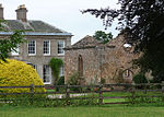
Mid Severn Sandstone Plateau
Landforms of ShropshireLandforms of StaffordshireNatural regions of EnglandPlateaus of EnglandShropshire geography stubs ... and 1 more
Staffordshire geography stubs

The Mid Severn Sandstone Plateau is a rural landscape and one of the natural regions of central England, straddling the border between the counties of Shropshire and Staffordshire. It stretches from the western fringes of the Birmingham conurbation to Telford in the north and Kidderminster in the south. The major feature of the plateau is the valley of the River Severn, which cuts through it from north to south. It consists of Permian and Triassic-age New Red Sandstone getting older as one goes west until one reaches Silurian and Carboniferous-age siltstones and coals west of the river.
Excerpt from the Wikipedia article Mid Severn Sandstone Plateau (License: CC BY-SA 3.0, Authors, Images).Mid Severn Sandstone Plateau
Geographical coordinates (GPS) Address Nearby Places Show on map
Geographical coordinates (GPS)
| Latitude | Longitude |
|---|---|
| N 52.509166666667 ° | E -2.3036111111111 ° |
Address
Claverley
England, United Kingdom
Open on Google Maps


