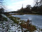
Morfe Forest
English royal forestsForests and woodlands of ShropshireShropshire geography stubs
Morfe Forest was a medieval royal forest in east Shropshire. The forest was perambulated in 1300 and the bounds were recorded. The forest was bounded by the River Severn on the west, by the River Worfe on the north and stretched east to Abbots Castle Hill and south into Kings Nordley. At its core was a wood stretching from Bridgnorth to Six Ashes (near Enville) and Claverley. By the 17th century, the wood had become a heath, which was enclosed in 1805. The forest takes its name from the manor of Morfe (in Enville) which was however not part of the forest.
Excerpt from the Wikipedia article Morfe Forest (License: CC BY-SA 3.0, Authors).Morfe Forest
Geographical coordinates (GPS) Address Nearby Places Show on map
Geographical coordinates (GPS)
| Latitude | Longitude |
|---|---|
| N 52.523 ° | E -2.346 ° |
Address
WV15 5PS
England, United Kingdom
Open on Google Maps


