place

Hampshire Downs

Hampshire geography stubsHills of HampshireNatural regions of England
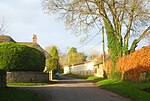
Hampshire Downland above Alresford geograph.org.uk 507886

The Hampshire Downs form a large area of downland in central southern England, mainly in the county of Hampshire but with parts in Berkshire and Wiltshire. They are part of a belt of chalk downland that extends from the South Downs in the southeast, north to the Berkshire and Marlborough Downs, and west to the Dorset Downs. The downs have been designated a National Character Area (NCA 130) by Natural England, the UK Government's advisor on the natural environment. To the north lie the Thames Basin Heaths, to the east the Low Weald (Western Weald), to the south the South Hampshire Lowlands and the South Downs, and, to the west, Salisbury Plain and the West Wiltshire Downs.The northern boundary of the Hampshire Downs follows a line from just north of Walbury Hill in Berkshire to Basingstoke and Farnham, forming a ridge and dramatic escarpment which rises to over 290 metres, overlooking the Thames Basin. In the east the boundary runs from Farnham to Alton, then swings southwards to Petersfield, forming an escarpment at the western edge of the Weald, including an area known as the East Hampshire Hangers. In the south the boundary runs westwards to Winchester, south to Twyford and Otterbourne, then west-northwest to Michelmersh; and in the west from Michelmersh through the Wallops to Ludgershall in Wiltshire, and back to Walbury Hill.The main rivers of the Hampshire Downs are the Test and River Itchen. The main settlements in the area are Andover, Alton, Basingstoke and Winchester. 20% of the area (the North Hampshire Downs) falls within the North Wessex Downs AONB, and around 6% within the South Downs National Park.

Excerpt from the Wikipedia article Hampshire Downs (License: CC BY-SA 3.0, Authors, Images).

Hampshire Downs
Long Walk, Winchester Micheldever

Geographical coordinates (GPS) Address Nearby Places
placeShow on map

Wikipedia: Hampshire DownsContinue reading on Wikipedia

Geographical coordinates (GPS)

Latitude Longitude
N 51.14 ° E -1.24 °
placeShow on map

Address

Long Walk

Long Walk
SO21 3BP Winchester, Micheldever
England, United Kingdom
mapOpen on Google Maps

Hampshire Downland above Alresford geograph.org.uk 507886
Share experience

Nearby Places

Stratton Park
Stratton Park

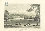
Stratton Park, in East Stratton, Hampshire, was an English country house, built on the site of a grange of Hyde Abbey after the dissolution of the monasteries; it was purchased with the manor of Micheldever in 1546 by Thomas Wriothesley, 1st Earl of Southampton. The last earl of Southampton made Stratton Park one of his chief seats, and his son-in-law, Sir William Russell, pulled down part of the hamlet and added it to his deer park in the 1660s. The Russell heirs eventually sold the estate in 1801 to Sir Francis Baring, Bt, of the Baring banking family. Baring remodeled the manor house in a neoclassical style, to designs by George Dance the Younger, 1803–06,' including an imposing stone Doric-columned portico and stuccoed brick main block and wings. The pleasure grounds and landscape park were laid out and planted, starting ca 1803 by Humphry Repton, and described by William Cobbett, in Rural Rides: in the counties of Surrey, Kent, Sussex, Hants, when Stratton Park held the living of Micheldever and included Micheldever Wood, which Cobbett said "contains a thousand acres [4 km²], and which is one of the finest oak-woods in England." In the late nineteenth century Thomas Baring, 1st Earl of Northbrook laid out more formally structured gardens, with hardy plantings by Gertrude Jekyll. The park has been Grade II registered since 1984.Most of the Stratton Park house was demolished in 1963 by owner John Baring, 7th Baron Ashburton, whose involvement in the demolition of the Baring family's architecturally important banking headquarters in London had earned him the nickname "Basher Baring". Today, all that remains is Dance's stone portico, looming up near, but in no stable relation with, a modernist house by Stephen Gardiner and Christopher Knight, 1963-65. The portico is now a listed structure since 1983. Mature specimen trees from the landscape park tower above the present structure.