place

River Gele

Clwyd geography stubsRivers of Conwy County BoroughRivers of DenbighshireUse British English from August 2022Wales river stubs
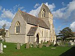
River Gele. geograph.org.uk 112834

The River Gele (Welsh: Afon Gele) is a river in the North Wales and a tributary of the River Clwyd. The town of Abergele takes its name from the river. The spelling is a dialectal spelling of the Welsh word gelau (spear or blade). The river gives its name to an electoral ward, called Gele, which includes the southern half of Abergele town. The river used to empty into the sea direct through the town of Abergele, but the Rhuddlan Marsh embankment act of 1794, diverted the river from the south of the town in an eastwards direction across the south of Rhuddlan Marsh and into the River Clwyd at Towyn. A short distance of the rivermouth is tidal.In 2010 and 2011 there were pollution scares on the river near its meeting point with the River Clwyd at Kinmel Bay. The river has also subjected the area to flooding, with the worst recorded event in 1971. This has led to a culverting of some areas and banks being installed on the floodplain to the east and south of Abergele.

Excerpt from the Wikipedia article River Gele (License: CC BY-SA 3.0, Authors, Images).

River Gele
Ffordd y Gors,

Geographical coordinates (GPS) Address Nearby Places
placeShow on map

Wikipedia: River GeleContinue reading on Wikipedia

Geographical coordinates (GPS)

Latitude Longitude
N 53.2944 ° E -3.5347 °
placeShow on map

Address

Ffordd y Gors

Ffordd y Gors
LL22 9NR , Kinmel Bay and Towyn
Wales, United Kingdom
mapOpen on Google Maps

River Gele. geograph.org.uk 112834
Share experience

Nearby Places

Kinmel Bay and Towyn

Kinmel Bay and Towyn (Welsh: Bae Cinmel a Tywyn) is a community in Conwy County Borough, in Wales. It is located on the coast bordering Denbighshire, from which it is separated by the River Clwyd, and is 2.6 miles (4.2 km) west of Rhyl, 2.5 miles (4.0 km) north east of Abergele and 14.1 miles (22.7 km) east of Conwy. The community includes the holiday resorts of Kinmel Bay and Towyn. It is crossed by the Afon Gele, which flows from west to east, before joining the River Clwyd on the eastern boundary. At the 2001 census the community had a population of 7,864, increasing to 8,460 at the 2011 census. Before being named Kinmel Bay there was a small settlement called Foryd, which is the name of the bridge crossing into Rhyl. The area is very Anglicized, with well over half the population having been born in England.The area was developed after 1793, when the Rhuddlan Marsh Commissioners were granted powers to drain the area around Towyn. In the mid 19th century, flood defences were constructed to protect the new Chester to Holyhead railway. Storm-force winds, a high tide and storm surge caused the defences to fail over a 440-yard (400 m) stretch in 1990, resulting in the flooding of 2,800 properties. The flood water covered 4 square miles (10 km2). Since then a rock revetment has been constructed to protect the breached coastline, and further protective works have been carried out to the east.St Mary's Church, in Towyn, was built in 1873 and designed by George Edmund Street, who was also the architect for the Royal Courts of Justice in London. It is in the Early Decorated style, and is Grade II* listed, as is the nearby Towyn and Kinmel Bay Youth Club, built two years earlier and also designed by Street. Also listed is the third building of Street's contract, the former vicarage, now Ty'n Llan Nursing Home. Horror writer James Henry Kinmel Sangster was born in Kimmel Bay in 1927.