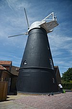
Walberton
Arun DistrictUse British English from January 2021Villages in West Sussex

Walberton is a village and civil parish in the Arun District of West Sussex, England, 5 miles (8 km) north-west of Littlehampton, and south of the A27 road. The land rises from 33–115 feet (10–35 m) above sea level, a quarter of the height of Nore Hill, the nearest foothill of the South Downs, which is to the north of the parish. The parish includes the smaller village of Binsted to the east and the larger neighbourhood of Fontwell, less than two-thirds of a mile (1 km) to the north-west. Walberton has a medieval church next to its clustered centre. Binsted's medieval church retains an original setting of village houses dispersed over farm fields.
Excerpt from the Wikipedia article Walberton (License: CC BY-SA 3.0, Authors, Images).Walberton
The Street, Arun
Geographical coordinates (GPS) Address Nearby Places Show on map
Geographical coordinates (GPS)
| Latitude | Longitude |
|---|---|
| N 50.84471 ° | E -0.6198 ° |
Address
The Street
The Street
BN18 0PJ Arun
England, United Kingdom
Open on Google Maps


