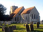
Houghton, West Sussex
Arun DistrictVillages in West Sussex

Houghton () is a low-population, linear settlement with a large elevated tract of land which is mostly wooded and two main farms forming its civil parish in the Arun District of West Sussex, England. It is on the River Arun, where it has a bridge to a rural part of Amberley, 3 miles (5 km) north of Arundel. The area is, equally, part of the South Downs National Park. The census 2011 included the population of South Stoke.
Excerpt from the Wikipedia article Houghton, West Sussex (License: CC BY-SA 3.0, Authors, Images).Houghton, West Sussex
Turnpike Road, Arun
Geographical coordinates (GPS) Address Nearby Places Show on map
Geographical coordinates (GPS)
| Latitude | Longitude |
|---|---|
| N 50.89441 ° | E -0.55318 ° |
Address
Turnpike Road
Turnpike Road
BN18 9LN Arun
England, United Kingdom
Open on Google Maps


