place

Eccles Pike

Chapel-en-le-FrithMountains and hills of DerbyshireMountains and hills of the Peak DistrictMountains and hills of the United Kingdom with toposcopes
Eccles Pike from Bagshaw

Eccles Pike is an isolated hill three miles west of Chapel en le Frith in the Derbyshire Peak District, England. It consists of gritstone, pink in colour at the summit. While not as prominent as the surrounding hills of Cracken Edge and Combs Moss, it is popular with walkers. At 370 metres (1,210 ft) above sea level, it offers good views of Manchester to the west and the Kinder Scout plateau to the east. Combs Reservoir lies just south of the hill. The name 'pike' means pointed hill; it's not known how it acquired the name Eccles, or whether this name relates to the town on the other side of Manchester famous for its currant cakes.

Excerpt from the Wikipedia article Eccles Pike (License: CC BY-SA 3.0, Authors, Images).

Eccles Pike
Eccles Road, High Peak Chapel-en-le-Frith

Geographical coordinates (GPS) Address External links Nearby Places
placeShow on map

Wikipedia: Eccles PikeContinue reading on Wikipedia

Geographical coordinates (GPS)

Latitude Longitude
N 53.328 ° E -1.949 °
placeShow on map

Address

Eccles Pike

Eccles Road
SK23 9RS High Peak, Chapel-en-le-Frith
England, United Kingdom
mapOpen on Google Maps

linkWikiData (Q5332205)
linkOpenStreetMap (2466906385)

Eccles Pike from Bagshaw
Share experience

Nearby Places

Combs Reservoir
Combs Reservoir

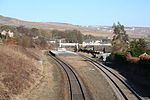
Combs Reservoir is a canal-feeder reservoir in the Peak District National Park, close to Combs village in Derbyshire. The town of Chapel-en-le-Frith lies about 1 kilometre (0.62 mi) east of the reservoir.Combs was built in 1797 as the first reservoir to feed the Peak Forest Canal (which opened in 1800) at Whaley Bridge. The canal was critical for transporting goods to and from the corn mills, cotton factories, collieries, and other local industries, as well as connecting to the Ashton Canal for the nearby limestone quarries. In 1831 the Macclesfield Canal was completed, which was connected to the Peak Forest Canal at Marple. The Toddbrook Reservoir at Whaley Bridge was built as an additional feeder reservoir and the dam at Combs Reservoir was raised between 1834 and 1840, in order to meet the demand for a greater water supply to the extended canal system. By the 1940s use of these canals for transporting industrial goods had ended. The reservoir is now owned by the Canal & River Trust.The Buxton to Manchester railway line runs between Combs Reservoir and Combs village to the south and alongside the western shore.The reservoir is overlooked by Eccles Pike hill from the north and from the south by the Iron Age promontory hillfort Castle Naze, at the northern end of Combs Moss. Castle Naze is a protected Scheduled monument.Combs Reservoir is a designated Site of Special Scientific Interest (SSSI). It is particularly important for its 'ephemeral bryophyte' mosses (such as the rare Physcomitrium sphaericum) and liverworts (Ricca glauca and Fossombronia wondraczekii). The area is a rich habitat for birdlife including the great crested grebe, little ringed plover, snipe and lapwing.Combs Sailing Club has used the reservoir for sailing training and racing since 1950.

Bugsworth Basin
Bugsworth Basin

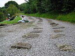
Bugsworth Basin is a canal basin at the terminus of the Peak Forest Canal at Buxworth (formerly Bugsworth) in the valley of the Black Brook, close to Whaley Bridge. It was once a busy interchange with the Peak Forest Tramway, for the transport of limestone and burnt lime.Work on the restoration of the derelict Bugsworth Basin, a Scheduled Ancient Monument since 1977, commenced in 1968. Volunteers of the Inland Waterways Protection Society (IWPS) helped by the Waterway Recovery Group (WRG) and many locals restored parts of this important site over three decades. The IWPS obtained a 50-year lease in 1992, which allowed them to restore, manage and operate the basin. Funding for the improvements came from British Waterways, the European Regional Development Fund and a Derelict Land Grant from Derbyshire County Council. The basin was reopened to boats at Easter 1999, and a significant increase in the use of the canal occurred. However, this was the first time that powered boats had used the basin, and the dry-stone walling with clay puddling deteriorated rapidly. Walls collapsed, there were several near breaches, and a breach resulted in the basin closing again in October 1999. British Waterways restored pedestrian access to the basin by carrying out emergency repairs.In 2005 the basin reopened to boat traffic after a £1.2 million restoration, undertaken by British Waterways working with the IWPS. Work included sealing the bottom of the basin to stop leakage, stonework repair and environmental measures to conserve the site's protected water vole population. Although restoration and reopening of the basin has been achieved, waterways enthusiasts want to make future improvements and developments. These include an interpretative exhibition about Bugsworth's history and reopening part of the tramway. Bugsworth Basin was officially reopened on 26 March 2005 when 94 narrowboats attended the opening ceremony. The opening was performed by Tom Levitt, the then member of parliament for High Peak.The basin is on the fringe of the Peak District National Park and the purpose of the restoration was to develop this industrial heritage site as a tourist centre.