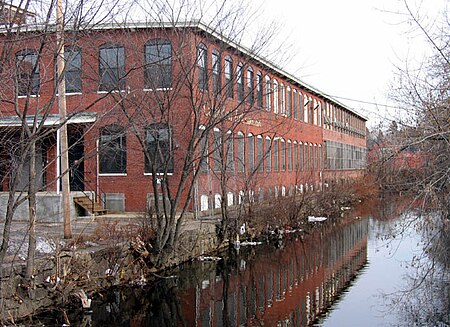
Woonasquatucket River
American Heritage RiversGeography of Providence, Rhode IslandRivers of Providence County, Rhode IslandRivers of Rhode IslandTributaries of Providence River

The Woonasquatucket River (pronounced , Algonquian for "where the salt water ends") is a river in the U.S. state of Rhode Island. It flows approximately 15.8 miles (25.4 km) and drains a watershed of 130 km2 (50 sq mi).Together with the Blackstone River to the north, the Woonasquatucket was designated an American Heritage River in 1998. Both rivers played active roles in the industrial revolution and the history of Rhode Island in the 19th century. Evidence of this industrial history remains in the fact that there are 18 dams along the river's length.
Excerpt from the Wikipedia article Woonasquatucket River (License: CC BY-SA 3.0, Authors, Images).Woonasquatucket River
Washington Place, Providence
Geographical coordinates (GPS) Address Nearby Places Show on map
Geographical coordinates (GPS)
| Latitude | Longitude |
|---|---|
| N 41.8267 ° | E -71.41 ° |
Address
Washington Place
Washington Place
02903 Providence
Rhode Island, United States
Open on Google Maps


