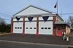
Unionville, Montgomery County, Pennsylvania

Unionville is a suburban community in the Delaware Valley located on Route 309. It is mainly in Hatfield Township, Montgomery County but also in Hilltown Township, Bucks County. 309 (Bethlehem Pike) follows the county line between the beginning of the expressway and Line Lexington. Montgomery students are served by North Penn School District while Bucks students are served by Pennridge School District. It is drained by the West Branch Neshaminy Creek, a tributary of the Neshaminy Creek. It is served by the Hatfield post office which uses the zip code of 19440. [1] Dock Meadows has a Mennonite-affiliated retirement community in the Bucks portion of Unionville.
Excerpt from the Wikipedia article Unionville, Montgomery County, Pennsylvania (License: CC BY-SA 3.0, Authors, Images).Unionville, Montgomery County, Pennsylvania
Bethlehem Pike, Hatfield Township
Geographical coordinates (GPS) Address Nearby Places Show on map
Geographical coordinates (GPS)
| Latitude | Longitude |
|---|---|
| N 40.298333333333 ° | E -75.283055555556 ° |
Address
Wawa
Bethlehem Pike 2480
19440 Hatfield Township
Pennsylvania, United States
Open on Google Maps


