Thetford

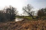
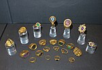
Thetford is a market town and civil parish in the Breckland district of Norfolk, England. It is on the A11 road between Norwich and London, just east of Thetford Forest. The civil parish, covering an area of 29.55 km2 (11.41 sq mi), in 2015 had a population of 24,340.There has been a settlement at Thetford since the Iron Age, and parts of the town predate the Norman Conquest; Thetford Castle was established shortly thereafter. Roger Bigod founded the Cluniac Priory of St Mary in 1104, which became the largest and most important religious institution in Thetford. The town was badly hit by the dissolution of the monasteries, including the castle's destruction, but was rebuilt in 1574 when Elizabeth I established a town charter. After World War II, Thetford became an "overspill town", taking people from London, as a result of which its population increased substantially. Thetford was the headquarters of Tulip International, large-scale manufacturers of bacon, beef and pork until its closure in 2010. Thetford railway station is served by the Breckland line and is one of the best surviving pieces of 19th century railway architecture in East Anglia.
Excerpt from the Wikipedia article Thetford (License: CC BY-SA 3.0, Authors, Images).Thetford
Icknield Way, Breckland District
Geographical coordinates (GPS) Address Nearby Places Show on map
Geographical coordinates (GPS)
| Latitude | Longitude |
|---|---|
| N 52.41 ° | E 0.74 ° |
Address
Icknield Way 8
IP24 3BA Breckland District
England, United Kingdom
Open on Google Maps


