place

Ligota-Panewniki

Districts of KatowiceNazi war crimes in PolandSilesian geography stubs
Panewniki Hedwig
Panewniki Hedwig

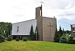
Ligota - Panewniki (German: Ellgoth-Panewnik; also "Idaweiche") is a district of Katowice in Poland. It has an area of 12.59 km2 and in 2007 had 31,879 inhabitants.Ligota-Panewniki is famous due to the magnificent Franciscan Basilica, the headquarters of the Franciscan Assumption Province in Poland. During Christmas the church becomes a religious and tourist attraction due to its Christmas Nativity scene, which supposedly is the biggest in Europe. In September 1939, Panewniki was one of the sites of large massacres of Polish defenders of Katowice, carried out by the Germans following the invasion of Poland, which started World War II (see Nazi crimes against the Polish nation). During the subsequent German occupation, the occupiers operated two forced labour camps in Ligota: one for Poles (Polenlager), and one for Jews.

Excerpt from the Wikipedia article Ligota-Panewniki (License: CC BY-SA 3.0, Authors, Images).

Ligota-Panewniki
Panewnicka, Katowice Panewniki (Ligota-Panewniki)

Geographical coordinates (GPS) Address Phone number Website Nearby Places
placeShow on map

Wikipedia: Ligota-PanewnikiContinue reading on Wikipedia

Geographical coordinates (GPS)

Latitude Longitude
N 50.226886111111 ° E 18.962605555556 °
placeShow on map

Address

Bazylika pw. Świętego Ludwika Króla i Wniebowzięcia Najświętszej Maryi Panny (Bazylika pw. Świętego Ludwika Króla i Wniebowzięcia Najświętszej Maryi Panny)

Panewnicka
40-762 Katowice, Panewniki (Ligota-Panewniki)
Silesian Voivodeship, Poland
mapOpen on Google Maps

Phone number

call+48322526870

Website
parafia.panewniki.pl

linkVisit website

Panewniki Hedwig
Panewniki Hedwig
Share experience

Nearby Places

Piotrowice (Katowice)

Piotrowice (German: Petrowitz, Czech: Petrovice) is a part of Katowice, located in the southwestern part of the city, in the Piotrowice-Ochojec district. It is one of the oldest settlements within the modern boundaries of Katowice, with its history dating back to the historic settlement of Uniczowy. The first mention of the village of Piotrowice appears in a document from the mid-15th century. Until the early 20th century, Piotrowice was a typical agricultural settlement, where mills were also operating, including several on the Ślepotka river. Over time, the village transformed into an industrial settlement, and the population grew, along with the development of educational and cultural activities. In 1907, a factory for mining machinery – later known as Famur – was established in Piotrowice. In April 1951, Piotrowice were incorporated into Katowice, and during the times of the Polish People's Republic, new residential estates were built in the district: Targowisko and Odrodzenia. The main thoroughfares of Piotrowice are: Tadeusza Kościuszko Street (part of the national road 81), Armii Krajowej Street, and Zygmunt Walter-Janke Street. Additionally, the northern part of the settlement is crossed by a railway line, where the Katowice Piotrowice train station is located – the station building itself is the seat of the Iron Theater. Piotrowice is home to various types of enterprises, and it also houses the Police School in Katowice and the Wojciech Korfanty University of Silesia.

Brynów-Osiedle Zgrzebnioka

Brynów-Osiedle Zgrzebnioka (full name: Brynów część wschodnia-Osiedle Zgrzebnioka) is a district of Katowice, located in the central part of the city, within the western district cluster. It borders four other districts: Śródmieście, Osiedle Paderewskiego – Muchowiec, Piotrowice-Ochojec, and Załęska Hałda-Brynów. This district primarily encompasses the eastern part of the historical Brynów municipality, along with the estates established within it, such as Brynów A, Ptasie, and Zgrzebnioka, as well as new housing complexes developed in the area around Ceglana and Meteorologów streets. The first mention of Brynów dates back to 1474, and until the 19th century, it was an agricultural settlement. In 1801, the Beate coal mine was established, and in 1823, the Henriette zinc smelter was founded. With the opening of the Oheim coal mine (later known as Wujek) in 1899, the northern part of the present district, Katowicka Hałda, began to develop rapidly. In 1888, on the grounds of the former Beate mine, a new park complex was being created in a suburban forest, and between 1894 and 1895, Süd Park was established, later renamed Kościuszko Park in 1925. In 1912, the first tram arrived in the area from downtown Katowice, and in 1938, the wooden Church of St. Michael the Archangel was moved to Kościuszko Park. During the Polish People's Republic, new residential estates were built, such as Brynów A, Brynów B (Ptasie Estate), and Zgrzebniok Estate. On 5 February 1990, an ophthalmological hospital was opened in the district, and after 1989, the area around Ceglana Street became a hub for new housing investments. Brynów-Osiedle Zgrzebnioka is a district with a dominant residential and recreational function, along with developed healthcare and administrative-office functions. It is home to one of the two facilities of the Professor Kornel Gibiński University Clinical Center in Katowice. A key cultural point in the district is Park Hall, where various concerts and events are organized, as well as Kościuszko Park, which, aside from its recreational role, serves as a venue for cultural events. The northern boundary of the district is defined by the A4 autostrada, which is part of the European route E40, and key internal roads in the district include Mikołowska, Brynowska, and Tadeusz Kościuszko streets – the latter also hosts a tram line that connects the district with the city center. The area of the district is 4.08 km², which constitutes 2.48% of the city's total area, and at the end of 2020, it was home to 6,384 people (2.34% of Katowice's population).