Central City, New Orleans

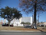
Central City is a neighborhood of the city of New Orleans. It is located in the 11th Ward of New Orleans in Uptown, just above the Garden District, on the "lakeside" of St. Charles Avenue. A subdistrict of the Central City/Garden District Area, its boundaries as defined by the City Planning Commission are: MLK Boulevard, South Claiborne Avenue and the Pontchartrain Expressway to the north, Magazine, Thalia, Prytania and Felicity Streets and St. Charles Avenue to the south and Toledano Street, Louisiana Avenue and Washington Avenue to the west. This old predominantly African-American neighborhood has been important in the city's brass band and Mardi Gras Indian traditions.
Excerpt from the Wikipedia article Central City, New Orleans (License: CC BY-SA 3.0, Authors, Images).Central City, New Orleans
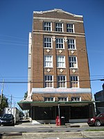
Jackson Avenue, New Orleans Garden District
Geographical coordinates (GPS) Address Nearby Places Show on map
 Continue reading on Wikipedia
 Geographical coordinates (GPS)
| Latitude | Longitude |
|---|---|
| N 29.941388888889 ° | E -90.086944444444 ° |
Address
Jackson Avenue 2404
70113 New Orleans, Garden District
Louisiana, United States
Open on Google Maps