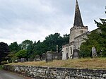
Sudbury Rural District
Derbyshire geography stubsDistricts of England created by the Local Government Act 1894History of DerbyshireRural districts of EnglandUse British English from August 2012
Sudbury was a rural district of Derbyshire in England from 1894 to 1934. It was created from the part of the Uttoxeter rural sanitary district that was in Derbyshire (with the larger part in Staffordshire forming the Uttoxeter Rural District). It consisted of the parishes of Boyleston, Cubley, Doveridge, Marston Montgomery, Norbury and Roston, Somersal Herbert and Sudbury. It was abolished in 1934 under a County Review Order, and its area transferred to Ashbourne Rural District.
Excerpt from the Wikipedia article Sudbury Rural District (License: CC BY-SA 3.0, Authors).Sudbury Rural District
Somersal Lane, Derbyshire Dales
Geographical coordinates (GPS) Address Nearby Places Show on map
Geographical coordinates (GPS)
| Latitude | Longitude |
|---|---|
| N 52.93 ° | E -1.8 ° |
Address
Somersal Lane
Somersal Lane
DE6 2FE Derbyshire Dales
England, United Kingdom
Open on Google Maps


