place

Lincoln Highway Hackensack River Bridge

1954 establishments in New JerseyBridges completed in 1954Bridges in Hudson County, New JerseyBridges of the United States Numbered Highway SystemBridges over the Hackensack River
East Coast GreenwayFormer toll bridges in New JerseyKearny, New JerseyLincoln HighwayRoad bridges in New JerseySteel bridges in the United StatesU.S. Route 1U.S. Route 9Vertical lift bridges in New Jersey
Lincoln Highway Lift Br fr Duncan Av jeh

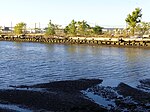
The Lincoln Highway Hackensack River Bridge is a vehicular vertical lift bridge crossing the Hackensack River at a point 1.8 mi (2.9 km) from the river mouth at Newark Bay in Hudson County, New Jersey, United States. The bridge, along the route of the Lincoln Highway, carries U.S. Route 1/9 Truck (at milepoint 1.72) and the East Coast Greenway between the West Side of Jersey City and Kearny Point in Kearny. The most recent of many crossings at the location, the current bridge was completed in 1954. It is owned by and operated by the New Jersey Department of Transportation (NJDOT), and is required by the Title 33 of the Code of Federal Regulations to open on signal for maritime traffic. In 2007 it was designated the Shawn Carson and Robert Nguyen Memorial Bridge.

Excerpt from the Wikipedia article Lincoln Highway Hackensack River Bridge (License: CC BY-SA 3.0, Authors, Images).

Lincoln Highway Hackensack River Bridge
Lincoln Highway,

Geographical coordinates (GPS) Address Nearby Places
placeShow on map

Wikipedia: Lincoln Highway Hackensack River BridgeContinue reading on Wikipedia

Geographical coordinates (GPS)

Latitude Longitude
N 40.727222222222 ° E -74.098888888889 °
placeShow on map

Address

Lincoln Highway Hackensack River Bridge

Lincoln Highway
07032
New Jersey, United States
mapOpen on Google Maps

Lincoln Highway Lift Br fr Duncan Av jeh
Share experience

Nearby Places

South Kearny, New Jersey

South Kearny, also known as Kearny Point, is an industrial district and distinct area of the western part of Hudson County, New Jersey at the northern end of Newark Bay in the town of Kearny, New Jersey. It is on the larger peninsula once called New Barbadoes Neck, which also include the other Kearny districts of the Uplands (a part of which is called Arlington) and the Kearny Meadows. It has been known as Kearny Point and, along Droyer's Point in Jersey City, marks the mouth of the Hackensack River to the east. The Passaic River flows along its western border opposite a similarly industrial portion of the Ironbound district of Newark. Most of the point is part of Foreign-Trade Zone 49The Newark and New York Railroad Bridge, part of Central Railroad of New Jersey, The Newark Plank Road, and the Morris Canal all crossed the point running parallel to each other. Currently, both the Lincoln Highway and The Pulaski Skyway traverse South Kearny, a ramp of the latter built specifically to spur industrial development Among the many facilities that are located there are the Hudson County Correctional Facility and River Terminal, a massive distribution warehouse that includes the former site of a Western Electric's Kearny Works manufacturing plant and the Kearny Yard of Federal Shipbuilding and Drydock Company.Road Movie was the filmed there in 1974. Two film television studios opened on Kearny Point in 2000s, Palsisades Stages and 10 Basin Studios.

PJP Landfill

The United States Environmental Protection Agency added the PJP Landfill site in Marion Section of Jersey City, New Jersey to the Superfund National Priorities List on September 1, 1983, because hazardous chemicals were found in the soil and groundwater. The 87-acre site located in Hudson County contained a landfill that may have been used as early as 1968 to dispose of chemical and industrial wastes. In 1971 the State certified the landfill to receive solid wastes. Approximately 11,900 people currently reside within a one-mile radius of the site. The west side of the site is bordered by the Hackensack River which is used for boating and commercial shipping. Recently, AMB Corporation purchased a portion of the site.The initial response action began in 1985 when the New Jersey Department of Environmental Protection extinguished the landfill fires, capped the landfill, and installed a gas venting system to prevent the buildup of gas within the landfill. The Remedial Action Construction began when the New Jersey Department of Environmental Protection and the EPA approved the Final Design Report. The report was developed to provide the proposed design for a cap cover system. It has four main objectives: to eliminate exposure to contaminated sediments in the Sip Avenue Ditch, prevent additional contaminant influx into the ground water via rainwater, remove contaminant sources that may impact ground water, and the implementation of models to evaluate if future actions are necessary to limit the leaching of contaminants into the Hackensack River. In 2008, AMB Corporation bought approximately 51.76 acres of the site. This property will be capped and a warehouse will be constructed, while the rest of the property AMB owns will be turned into greenspace. The remaining portion of the site is under the responsibility of Waste Management of New Jersey, Inc. and CWM Chemical Services, LLC (collectively “CCS”). The work they are responsible for includes: a multi-layer, modified solid waste cap, wetlands reconstruction and enhancement efforts, and environmental monitoring. The Remedial Action Construction began in 2008. It has been redeveloped, and is home to a warehouse and a walkway. Some theorize that Jimmy Hoffa is buried there.The site was designated as the space for the first North American memorial for victims of the coronavirus pandemic.

West Side, Jersey City

The West Side of Jersey City is an area made up of several diverse neighborhoods on either side of West Side Avenue, one of the city's main shopping streets. Parallel and west of Kennedy Boulevard, West Side Avenue carries two county route designations.West Side Avenue at its northern end begins in the Marion Section as a dead end at the PATH trains, though there is no station there After crossing Broadway and Sip Avenue it passes Holy Name Cemetery on the west and nearby Saint Peter's College to the east. "The Bubble", an air-supported structure that is part of Yanitelli Center, is visible on the slope of Montgomery Street. Lincoln Park is one of the largest county parks in Hudson County and includes recreational facilities (tennis, track, athletic fields, golf range, biking, running) and picnicking areas. Overpasses provide pedestrian access over Truck 1-9 from the older, more urban eastern section of the park to the more natural west section on the Hackensack River. The streets ascending from the park contain an eclectic mix architectural styles including Victorian and Edwardian mansions, and pre-war and Art Deco apartment buildings in the Bergen Section. St Aloyius Church is a prominent landmark near the park. At Communipaw Avenue the street enters the heart of West Bergen. West Bergen is so called in reference Bergen-Lafayette Section and in the 19th century was part of Bergen Township and Bergen. (The name Bergen is from the original Bergen, New Netherland centered on Bergen Square). One of the very few older residential districts of the city west of the avenue radiates from Mallory Avenue as it runs south from Lincoln Park. The West Side Avenue Station is the terminus for the single branch of the Hudson Bergen Light Rail. The station is on an embankment above the east side of street, and consists of an island platform and two tracks. Bumper blocks are at the west end of the station, a pedestrian bridge and elevator connecting it a large park and ride lot and bus stations. The former Central Railroad of New Jersey right of way formerly continued west across the Newark and New York Railroad Bridge at Newark Bay and there are proposals to extend the line to a station close by. The Jersey City Board of Education is located nearby. The West Campus of New Jersey City University began development in 2006, and will more than double the campus's with academic buildings, residences, retail spaces, parking, and a "University Promenade." Along with Bayfront, Jersey City, another planned community, the West Side will be expanded with residential, retail, and recreational areas. West Side Avenue's southern end is the Country Village section of Greenville at Danforth Avenue close to NJ-440, across which is the Droyer's Point and completed sections of the Hackensack RiverWalk. New Jersey Transit bus routes #1, #80, #87 as well as A&C Bus Corporation serve the district.