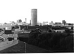
Hayes and Harlington Urban District

Hayes and Harlington (until 1930, Hayes) was a local government, urban district in west Middlesex, England from 1904 to 1965.It was created in 1904 as Hayes Urban District - covering the Hayes parish transferred from Uxbridge Rural District (including Yeading). In 1930 the district acquired the parishes Cranford and larger Harlington from the disbanded Staines Rural District at that time adding the "and Harlington" suffix. Its main boundary change occurred in 1934 coinciding with the abolition of internal Cranford civil parish, its east going to Heston and Isleworth M.B. (361 acres (1.46 km2)); the west remaining and added to Harlington parish (368 acres (1.49 km2)).In 1965, under the London Government Act 1963, Hayes and Harlington Urban District was abolished, the area becoming part of the London Borough of Hillingdon in Greater London. The district's name survives, however, in both the Hayes and Harlington Parliamentary constituency and Hayes and Harlington railway station.
Excerpt from the Wikipedia article Hayes and Harlington Urban District (License: CC BY-SA 3.0, Authors, Images).Hayes and Harlington Urban District
Nestle's Avenue, London Hayes (London Borough of Hillingdon)
Geographical coordinates (GPS) Address Website Nearby Places Show on map
Geographical coordinates (GPS)
| Latitude | Longitude |
|---|---|
| N 51.502 ° | E -0.4201 ° |
Address
Spaceships Campervan Rentals
Nestle's Avenue 236
UB3 4SH London, Hayes (London Borough of Hillingdon)
England, United Kingdom
Open on Google Maps


