Battle of Neville's Cross

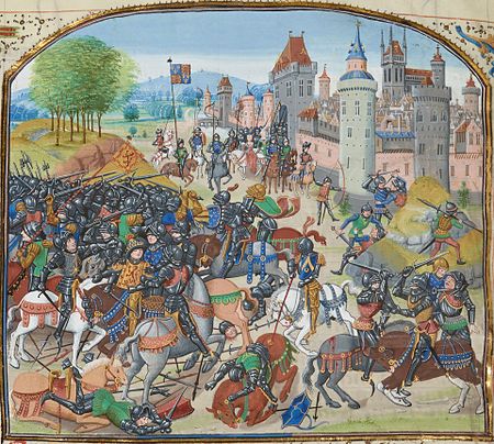
The Battle of Neville's Cross took place during the Second War of Scottish Independence on 17 October 1346, half a mile (800 m) to the west of Durham, England. An invading Scottish army of 12,000 led by King David II was defeated with heavy loss by an English army of approximately 6,000–7,000 men led by Ralph Neville, Lord Neville. The battle was named after an Anglo-Saxon stone cross that stood on the hill where the Scots made their stand. After the victory, Neville paid to have a new cross erected to commemorate the day. The battle was the result of the invasion of France by England during the Hundred Years' War. King Philip VI of France (r. 1328–1350) called on the Scots to fulfil their obligation under the terms of the Auld Alliance and invade England. David II obliged, and after ravaging much of northern England was taken by surprise by the English defenders. The ensuing battle ended with the rout of the Scots, the capture of their king and the death or capture of most of their leadership. Strategically, this freed significant English resources for the war against France, and the English border counties were able to guard against the remaining Scottish threat from their own resources. The eventual ransoming of the Scottish King resulted in a truce that brought peace to the border for forty years.
Excerpt from the Wikipedia article Battle of Neville's Cross (License: CC BY-SA 3.0, Authors, Images).Battle of Neville's Cross
St Johns Road, Durham Neville's Cross
Geographical coordinates (GPS) Address Nearby Places Show on map
Geographical coordinates (GPS)
| Latitude | Longitude |
|---|---|
| N 54.7725 ° | E -1.5933333333333 ° |
Address
St Johns Road 1
DH1 4NU Durham, Neville's Cross
England, United Kingdom
Open on Google Maps


