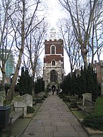
Bromley-by-Bow

Bromley, commonly known as Bromley-by-Bow, is a district in the London Borough of Tower Hamlets in East London, located on the western banks of the River Lea, in the Lower Lea Valley in East London. The area is distinct from Bow, which lies immediately north of the formal boundary between the two, which runs along Bow Road, or near the Lea, slightly to the south of the Road. The area has historically been known as both Bromley and Bromley-by-Bow. In 1967, the latter name was chosen as the new name for Bromley tube station, a change designed to prevent confusion with Bromley railway station in the London Borough of Bromley. The formal boundaries of the area were set when the area became a parish in 1537 when it split from Stepney. The boundaries of the new parish were based on those of much older pre-existing estates.Bromley has a rich history, but many of its most historic buildings have been lost. It is connected to the London Underground and Docklands Light Railway.
Excerpt from the Wikipedia article Bromley-by-Bow (License: CC BY-SA 3.0, Authors, Images).Bromley-by-Bow
Rainhill Way, London Bow
Geographical coordinates (GPS) Address Nearby Places Show on map
Geographical coordinates (GPS)
| Latitude | Longitude |
|---|---|
| N 51.5246 ° | E -0.017 ° |
Address
Rainhill Way
Rainhill Way
E3 3NS London, Bow
England, United Kingdom
Open on Google Maps


