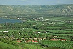
Ohalo II

Ohalo II is an archaeological site in Northern Israel, near Kinneret, on the southwest shore of the Sea of Galilee. It is one of the best preserved hunter-gatherer archaeological sites of the Last Glacial Maximum, radiocarbon dated to around 23,000 BP (calibrated). It is at the junction of the Upper Paleolithic and the Epipaleolithic, and has been attributed to both periods. The site is significant for two findings which are the world's oldest: the earliest brushwood dwellings and evidence for the earliest small-scale plant cultivation, some 11,000 years before the onset of agriculture. The numerous fruit and cereal grain remains preserved in anaerobic conditions under silt and water are also exceedingly rare due to their general quick decomposition.
Excerpt from the Wikipedia article Ohalo II (License: CC BY-SA 3.0, Authors, Images).Ohalo II
90, Emek HaYarden Regional Council
Geographical coordinates (GPS) Address Nearby Places Show on map
Geographical coordinates (GPS)
| Latitude | Longitude |
|---|---|
| N 32.722093 ° | E 35.572143 ° |
Address
90
Emek HaYarden Regional Council
North District, Israel
Open on Google Maps


