place

Wapping railway station

1869 establishments in EnglandFormer East London Railway stationsLondon Overground Night Overground stationsLondon stations without latest usage statistics 1415London stations without latest usage statistics 1516
Rail transport stations in London fare zone 2Railway stations in Great Britain opened in 1869Railway stations in the London Borough of Tower HamletsRailway stations located underground in the United KingdomRailway stations served by London OvergroundRailway stations with vitreous enamel panelsUse British English from August 2012Wapping
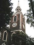
Wapping station building pre open April2010

Wapping is a station on the East London line located on the northern bank of the River Thames in Wapping within the London Borough of Tower Hamlets. The station is served by National Rail London Overground services under the control of the London Rail division of Transport for London, however there is no standard red National Rail "double arrow" logo signage located at the station, instead only the Overground roundel. The station is between Shadwell and Rotherhithe, and is in Travelcard Zone 2.After temporary closures for remodelling, the station reopened for preview services on 27 April 2010 for services to New Cross and New Cross Gate, and from 23 May 2010 trains to and from New Cross Gate were extended to West Croydon and Crystal Palace.

Excerpt from the Wikipedia article Wapping railway station (License: CC BY-SA 3.0, Authors, Images).

Wapping railway station
Wapping High Street, London Wapping

Geographical coordinates (GPS) Address Nearby Places
placeShow on map

Wikipedia: Wapping railway stationContinue reading on Wikipedia

Geographical coordinates (GPS)

Latitude Longitude
N 51.5044 ° E -0.0558 °
placeShow on map

Address

Wapping Overground

Wapping High Street
E1W 3PA London, Wapping
England, United Kingdom
mapOpen on Google Maps

Wapping station building pre open April2010
Share experience

Nearby Places

St Peter's, London Docks

St Peter's, Wapping, is a Grade I listed Anglican church in Wapping Lane, Wapping, London, E1W 2RW. It was built in 1865–1939, designed by F. H. Pownall.The church was the first Anglican mission to the poor of London. Work was begun in 1856 by the Revd Charles Lowder MA and a group of priests, all were members of the Society of the Holy Cross. The Society had been founded a year earlier with the express purpose of banding priests to a common rule of life and prayer in mission service.Wapping was one of the poorest districts in London, a haunt of prostitutes and petty criminals, living alongside those who earned a precarious living from the docks. Lowder's work began in Lower Well Alley (now the park by the James Orwell sports centre) and moved to an iron church in Calvert Street (now Tench Street). Lowder's group of Clergy and Sisters provided practical care through schools, clubs, cheap canteens and child care and spiritual care through a wide range of services, centred on the Mass at the Mission Churches. In 1866 the new Church of St Peter was consecrated. Soon afterwards cholera struck the East End. Lowder organised Sisters of Mercy and others to care for the sick and raised funds for a tented hospital. The Priests and Sisters took great risks and worked without stint for the people of Wapping. At the end of the cholera people were calling Lowder, ‘the Father’ because he seemed like the father of the whole community.After Lowder's death in 1880, Maurice Bingham Adams was engaged to design extensions in his memory. In 1884-94 a mortuary, chapel and baptistry were all added.Further work was done to the church in the 1930s, and finished in 1940, only to be immediately destroyed by a bomb in the Blitz. Repairs were completed in 1949. The church was completely renovated in 1985.Now it is used for church services in the area of Wapping and has a regular Thursday attendance from the nearby school whom uses this church which is St Peter's London Docks Primary.

Wapping Hydraulic Power Station

The Wapping Hydraulic Power Station (built 1890) was originally run by the London Hydraulic Power Company in Wapping, London, England. Originally, it operated using steam, and was later converted to use electricity. It was used to power machinery, including lifts, across London. The Tower Subway was used to transfer the power, and steam, to districts south of the river.The surviving complex consists of the engine house, boiler house, water tanks, accumulator tower, reservoir, boiler master's house, seven 1950s throw ram pumps, a 1950s pilot accumulator, a gantry crane, two transformers and switchgear. It is located at Wapping Wall. The building was designated a grade II* listed building in December 1977. After its closure as a pumping station on 30 June 1977, the building was converted by architectural practice Shed 54 and reopened by Jules Wright, as an arts centre and restaurant (Wapping Food). It held its first exhibition in 1993, and opened in a new form in 2000. Exhibitions were mounted across the building including the Boiler House and the Engine House, with most of the original equipment still in place. Women's Playhouse Trust sold the building in 2013 to focus on its core mission of commissioning new art. In 2013, the freehold of the building was sold to developers UK Real Estate Ltd.In March 2019 planning applications were submitted to Tower Hamlets Council for extensive renovation of the existing buildings, new buildings and extensive earth works of the old water reservoirs below the south court yard. The buildings are intended for office and restaurant space. Work is planned to commence in summer 2020 for completion during summer 2021.

Shadwell Basin
Shadwell Basin

Shadwell Basin is a housing and leisure complex built around a disused dock in Wapping, London. The old dock was formerly part of the London Docks, a group of docks built by the London Dock Company at Shadwell and Wapping as part of the wider docks of the Port of London. Today Shadwell Basin is one of the most significant bodies of water surviving from the historical London Docks. It is situated on the north side of the river Thames east (downstream) of the Tower of London and Tower Bridge and west (upstream) of Limehouse. Unlike some of the London Docks which have been landfilled, Shadwell Basin, the most easterly part of the complex, has been retained. It is now a maritime square of 2.8 hectares used for recreational purposes (including sailing, canoeing and fishing) and is surrounded on three sides by a waterside housing development designed by British architects MacCormac, Jamieson, Prichard and Wright. The residential buildings are four and five storeys with façades of alternating open arches and enclosed structure, echoing the scale of traditional 19th century dockside warehouses, with a colonnade at quayside. The development, made up of Newlands Quay, Maynards Quay and Peartree Lane, was added to the National Heritage List for England by Historic England as Grade II listed in 2018, part of a first-ever listing of Post-Modern buildings.Shadwell Basin has Benson Quay on its south-west corner with its south side overlooked by Riverside Mansions in Milk Yard and the Monza Building in Monza Street and, at its south-eastern end, the former Wapping Hydraulic Power Station building. On the north side of Shadwell Basin, east of Newlands Quay, St. Paul's Church, Shadwell provides a dramatic backdrop with its spire and the St Paul's Church Conservation Area extends to the water's edge with a terraced quayside that includes an outdoor gym. A Scherzer Bascule bridge spans one of the entrances on the East side of the basin. This was built in the 1930s by the Port of London Authority and was restored by the London Docklands Development Corporation during their redevelopment of the site in the 1980s. Shadwell Basin is a popular public route for cyclists, joggers and pedestrians with a walkway alongside the water as part of the linked open spaces and canals between the river and Hermitage Basin near St Katharine Docks to the west.