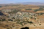
Mount Arbel

Mount Arbel (Hebrew: הר ארבל, Har Arbel) is a mountain in The Lower Galilee near Tiberias in Israel, with high cliffs, views of Mount Hermon and the Golan Heights, a cave-fortress, and ruins of an ancient synagogue. Mount Arbel sits across from Mount Nitai; their cliffs were created as a result of the geological processes leading to the creation of the Jordan Rift Valley. There are four villages on the mountain: Kfar Zeitim, Arbel, Kfar Hittim, and Mitzpa. The peak, at 181 metres above sea level (380 metres above the surrounding area), dominates the surroundings (much of the area is below sea level), and from the lookout atop the mountain, almost all of the Galilee is visible including Safed, as well as Tiberias and most of the Sea of Galilee, and the slopes of the Golan Heights on the other side of the Sea.
Excerpt from the Wikipedia article Mount Arbel (License: CC BY-SA 3.0, Authors, Images).Mount Arbel
El Mul Kinneret path, Galil Tachton Regional Council
Geographical coordinates (GPS) Address Website Nearby Places Show on map
Geographical coordinates (GPS)
| Latitude | Longitude |
|---|---|
| N 32.82455 ° | E 35.49994 ° |
Address
מצפור החרוב
El Mul Kinneret path
1427943 Galil Tachton Regional Council
North District, Israel
Open on Google Maps


