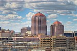
Albuquerque Basin

The Albuquerque Basin (or Middle Rio Grande Basin) is a structural basin and ecoregion within the Rio Grande rift in central New Mexico. It contains the city of Albuquerque. Geologically, the Albuquerque Basin is a half-graben that slopes down towards the east to terminate on the Sandia and Manzano mountains. The basin is the largest and oldest of the three major basins in the Rio Grande rift, containing sediments whose depth ranges from 4,407 to 6,592 meters (14,459 to 21,627 ft).The basin has a semi-arid climate, with large areas that count as semi-desert. Paleo-Indian traces dating back 12,000 years show that the climate used to be wetter and more fertile than it is today. The Rio Grande flows through the basin from north to south, and its valley has been irrigated for at least 1,000 years. Intense irrigation began in the late nineteenth century with new dams, levees and ditches and has caused environmental problems.In times of low water levels in the Rio Grande, Albuquerque relies on groundwater for its potable water supply. The aquifer is composed of deposits from the ancestral Rio Grande and the size of its annual recharge follows fluctuations in weather and climate phenomena. There may be natural gas in the basin, but opponents of gas extraction fear the impact on the groundwater and on the quality of life.
Excerpt from the Wikipedia article Albuquerque Basin (License: CC BY-SA 3.0, Authors, Images).Albuquerque Basin
Morningside Drive Northeast, Albuquerque Nob Hill
Geographical coordinates (GPS) Address Nearby Places Show on map
Geographical coordinates (GPS)
| Latitude | Longitude |
|---|---|
| N 35.1 ° | E -106.6 ° |
Address
Morningside Drive Northeast 1822
87110 Albuquerque, Nob Hill
New Mexico, United States
Open on Google Maps


