place

Pennichuck Brook

Nashua, New HampshireRivers of Hillsborough County, New HampshireRivers of New HampshireTributaries of the Merrimack River
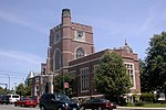
Nashua , NH WP 20180612 018

Pennichuck Brook is one of the tributaries of the Merrimack River in New Hampshire in the United States. Its watershed is 31 square miles (80 km2) and is one of the 14 subwatersheds of the Merrimack River. It passes through Nashua and Merrimack, New Hampshire and serves as the public water supply for greater Nashua.

Excerpt from the Wikipedia article Pennichuck Brook (License: CC BY-SA 3.0, Authors, Images).

Pennichuck Brook
Daniel Webster Highway,

Geographical coordinates (GPS) Address Nearby Places
placeShow on map

Wikipedia: Pennichuck BrookContinue reading on Wikipedia

Geographical coordinates (GPS)

Latitude Longitude
N 42.8 ° E -71.468888888889 °
placeShow on map

Address

Daniel Webster Highway 59
03054
New Hampshire, United States
mapOpen on Google Maps

Nashua , NH WP 20180612 018
Share experience

Nearby Places

Greeley Park
Greeley Park

Greeley Park is a public park in Nashua, New Hampshire, United States, occupying 125 acres (51 ha) extending from the Merrimack River, across Concord Street, to Manchester Street. The property was originally bought in 1801 by Joseph Greeley, who passed it on to his son after his death. The land was deeded to the city of Nashua in 1896 by Joseph Thornton Greeley, the grandson of the original Joseph Greeley. In 1908, John E. Cotton donated $5000, an amount that was "matched by city funds", to change the Greeley Farm into a public park. The money was used to create a "stone and cement rest house, a fountain, a shallow pond, a gravel walk, and flower beds". Greeley Park hosts many citywide events, such as the Fairy Tale Festival, Art Show, and Halloween "Fright Night", and is a traditional photogenic place for prom night for Nashua High School South and North. On a smaller scale, at the bandstand in the spring and summer there are plays, movies and music festivals. The park also features hiking trails, horseshoe pits, ball fields, tennis courts, a community gardening section, and the only boat ramp on the west side of the Merrimack River between the Massachusetts border and the first rapids in New Hampshire. At the northern boundary of the park, near the river, the park is dealing with the threat of creosote contamination that flows from the closed nearby historic railroad tie plant.During September 1999, American politician John McCain officially announced his candidacy for president of the United States to a crowd of around one thousand in Greeley Park, beginning his first presidential campaign.During June 2020, Black Lives Matter hosted a vigil for George Floyd that was attended by over 1,000 people

Boston Consolidated TRACON

The Boston Consolidated TRACON (A90) is located in Merrimack, New Hampshire. A90 opened in 2004 after 8 years of development. The A90 function transferred to the new Boston Consolidated TRACON on February 22, 2004. The MHT function transferred over on March 7, 2004. Manchester TRACON used to be located at Manchester Airport below the old ATCT. Boston TRACON used to be located at the Logan International Airport Control Tower before being consolidated. The new facility is 63,000 square feet (5,900 m2). A Terminal Radar Approach Control, or TRACON, is responsible for descending airplanes from the ARTCC and lining them up for landing at their destination airport, as well as climbing departures before handing off to the ARTCC. The primary responsibility of the Boston TRACON is the safe, orderly, and expeditious flow of arrival, departure, and en-route traffic. A90 is responsible for one main airport, Boston Logan International Airport. Additionally, A90 is responsible for dozens of smaller but busy fields, including Manchester-Boston Regional Airport, Hanscom Field, Norwood Memorial Airport, Beverly Municipal Airport, Lawrence Municipal Airport, Portsmouth International Airport at Pease, and Nashua Airport. The Boston TRACON is one of six "Medium TRACONs" currently existing throughout the United States. The others include the Salt Lake TRACON, the Bradley TRACON, the Indianapolis TRACON, the Pensacola TRACON, and the Des Moines TRACON. According to the FAA Air Traffic Activity Data System below are the traffic counts for A90: 2005 729,625 ops 2006 710,765 ops 2007 693,158 ops 2008 639,782 ops 2009 603,131 ops 2010 634,151 ops 2011 626,137 ops 2012 595,823 ops 2013 603,974 ops 2014 604,516 ops 2015 615,078 ops 2016 639,759 ops 2017 658,524 ops 2018 805,780 ops 2019 824,230 opsA90 is part of the FAA New England District. The Boston Consolidated TRACON is considered the HUB facility for the following facilities: Bangor ATCT/TRACON Manchester ATCT Boston ATCT Providence ATCT/TRACON Cape TRACON - Which was consolidated to A90 in February 2018 as part of the FAA's efforts to reduce its infrastructure footprint. Bedford ATCT Nantucket ATCT Portland ATCT/TRACON Burlington ATCT/TRACON

Nashville Historic District (Nashua, New Hampshire)

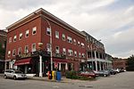
The Nashville Historic District in Nashua, New Hampshire is a historic district that was listed on the National Register of Historic Places (NRHP) in 1984. It encompasses an area just north of downtown Nashua, roughly centered on the junction of Concord, Amherst, and Main streets. Its southern bound is the Nashua River and Railroad Square, its eastern bounds are Railroad Square, Clinton, Lock, Orange, and Concord streets, its northern bound is Mount Pleasant Street, and its western boundary is Abbott, Amherst, Concord, and Main streets between the northern and southern bounds.Today this area is known as French Hill, but the NRHP district takes its name from a time in the 19th century when the area was briefly separated from Nashua as the town of "Nashville". This was due to the placement of a new Town Hall in the southern half of the city (which was more populated at the time). The northern contingent split themselves off, calling themselves "Nashville". The split came only six years after the town had renamed itself "Nashua", in 1836. The creation of a new railroad line from Lowell, Massachusetts, that ran along the northern length of the Nashua River had resulted in Union Square being renamed "Railroad Square" in 1838.However, the railroad brought new economic prosperity and increased communication with Boston, and in 1853 the two town committees resolved their differences and a new town charter for the "City of Nashua" was enacted.

Soldiers and Sailors Monument (Nashua, New Hampshire)

The Soldiers and Sailors Monument in Nashua, New Hampshire is an American Civil War memorial. Its cornerstone was laid on May 30, 1889, and the monument dedicated on October 15, 1889. The monument is located in central Nashua within the triangle formed by Concord, Amherst, and Nashville streets. The monument is a square, castellated column of New Hampshire granite from Nashua on a base of Quincy granite, atop which stands a figure of Victory, dressed in classical Roman garments and holding an American shield and a laurel wreath. Its base is ornamented with bronze statues of a soldier and sailor, and bronze reliefs depicting the Goddess of Liberty overseeing the reconciliation of the South with the North, an emancipation scene with a Union soldier extending a scroll to a kneeling figure, and the sinking of the Alabama by the Kearsarge. At its front is a sculpture of a saddle draped with cavalry clothing and equipment; at the rear is a sculpture of Civil War-era weapons. The design for the monument was made by T. M. Perry, of Messrs. Frederick & Field, who carved the Victory, erected the monument, and did all its granite work. The sailor was modeled by S. J. O'Kelley and cast by Melzar Hunt Mosman. The soldier was modeled by Caspar Buberl and cast by the Henry Bonnard Bronze Company. The artillery sculpture was made and cast by Melzar Hunt Mosman, as were the Emancipation bas-relief and the two lettered panels. The statue of Victory, cavalry sculpture, and sinking of the Alabama were modeled by Beattie & Brooks. On bronze plaque on lower front of monument: On bronze plaque on lower back of base: On relief plaque on base: On relief plaque on base:SINKING OF THE ALABAMA BY THE KEARSARGE JUNE 19, 1864