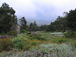
Gibraltar Dam

Gibraltar Dam is located on the Santa Ynez River, in southeastern Santa Barbara County, California, in the United States. Forming Gibraltar Reservoir, the dam is owned by the city of Santa Barbara. Originally constructed in 1920 and expanded in 1948, the dam and reservoir are located in a remote part of the Los Padres National Forest. The main purpose of Gibraltar Dam is domestic water supply. It provides about 4,600 acre-feet (5,700,000 m3) of water to Santa Barbara each year, supplying almost 30% of the city's needs. Water diverted from the dam also powers a small hydroelectric plant. Due to having lost a massive portion of its capacity to sediment build-up, the lake can often fill and spill after a single storm, while drying up completely in some years. As of February 2019, sedimentation has reduced the reservoir's capacity to 4,314 acre-feet (5,321,000 m3), only 19% of its designed capacity.The dam is built in a part of the Santa Ynez River called the "Gibraltar Narrows" that gave its name to the Gibraltar (or Sunbird) mercury mine, which operated next to what is now Gibraltar Reservoir between the 1870s and 1990s.
Excerpt from the Wikipedia article Gibraltar Dam (License: CC BY-SA 3.0, Authors, Images).Gibraltar Dam
Forest Route 5N18,
Geographical coordinates (GPS) Address Website Nearby Places Show on map
Geographical coordinates (GPS)
| Latitude | Longitude |
|---|---|
| N 34.526944444444 ° | E -119.68694444444 ° |
Address
Forest Route 5N18
California, United States
Open on Google Maps


