place

Blackwater Dam

Buildings and structures in Merrimack County, New HampshireDams completed in 1941Dams in New HampshireLandforms of Merrimack County, New HampshireReservoirs in New Hampshire
United States Army Corps of Engineers damsWebster, New Hampshire
USACE Blackwater Dam

Blackwater Dam is a dam in the town of Webster, Merrimack County, New Hampshire. The earthen dam was constructed in 1941 by the United States Army Corps of Engineers with a height of 69 feet (21 m) and 1,150 feet (350 m) long at its crest. It impounds the Blackwater River for flood control and storm water management as one of five related projects in the Merrimack River basin. The dam is owned and operated by the New England District, North Atlantic Division, Army Corps of Engineers. The seasonal flood-control reservoir created by the dam has a maximum capacity of 93,400 acre-feet (120 million cubic meters), but is normally dry, apart from the normal flow of the Blackwater. The site includes 8 miles (13 km) of river popular for canoeing and kayaking, and fishing for brown and rainbow trout.

Excerpt from the Wikipedia article Blackwater Dam (License: CC BY-SA 3.0, Authors, Images).

Blackwater Dam
White Plains Road,

Geographical coordinates (GPS) Address Nearby Places
placeShow on map

Wikipedia: Blackwater DamContinue reading on Wikipedia

Geographical coordinates (GPS)

Latitude Longitude
N 43.3162 ° E -71.72202 °
placeShow on map

Address

White Plains Road 28
03303
New Hampshire, United States
mapOpen on Google Maps

USACE Blackwater Dam
Share experience

Nearby Places

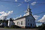
Webster Congregational Church

The Webster Congregational Church is a historic Congregational church off NH 127 on Long Street in Webster, New Hampshire, United States. The church was built in 1823 by George Pillsbury, a local builder, with interior joinery by William Abbot, another experienced church builder, and is an excellent representation of late Federal styling. The main facade has three entrances, each topped by a semicircular fanlight with reeded soffit. The central doorway has sidelight windows, while the flanking doors do not. On the second level there is a Palladian window above the central door, and smaller round-arch windows nearly above the flanking doors. The gable end of the roof is fully pedimented, with a semi-elliptical window in the tympanum.The tower begins with a square section that has a clock in the front face, and continues with an open belfry supported by columns topped by elliptical arches. Above the belfry is a smaller square lantern stage with louvered openings and corner pilasters. This is topped by a four-sided dome and finial. Each stage of the tower has a decorative balcony railing, shrinking in size, with matching corner posts topped by finials.The interior of the building consists of a large auditorium with gallery, and an entry vestibule with stairs on either side. The gallery is supported by turned posts that rise to an elaborate entablature that forms the base of the gallery's parapet. The interior is lit by a chandelier installed in 1884 and electrified in 1930.The church was listed on the National Register of Historic Places in 1985.

Blackwater River (Contoocook River tributary)

The Blackwater River is a 37.5-mile-long (60.4 km) river located in central New Hampshire in the United States. It is a tributary of the Contoocook River, part of the Merrimack River watershed. The Blackwater River is formed at Cilleyville, a village in the western part of the town of Andover, by the junction of two branch streams. Cascade Brook, the western branch, begins at Cascade Marsh in the northeast part of Sutton and flows northeast to Wilmot Flat, where it is joined by the outlet of Pleasant Lake of New London before continuing east to Cilleyville. Frazier Brook, the northern stream branch, rises just south of Danbury village and flows south parallel to Route 4, passing South Danbury, flowing through Eagle Pond in Wilmot and then through Bog Pond below West Andover, joining Cascade Brook just south of the outlet of Bog Pond. Kimpton Brook (formerly known as Quickwater Brook), flowing easterly through the village of Wilmot Center, is the primary tributary of Eagle Pond. From its start at Cilleyville, the Blackwater River flows east through the town of Andover, passing the village of Potter Place. Beyond Andover village, the river continues to wind its way east, eventually turning south near the Blackwater Bays and dropping over rapids through the village of West Salisbury to the impoundment area of the Blackwater Dam in the town of Webster. Below the reservoir dam, the Blackwater encounters a short, intense whitewater stretch before flattening again for the final miles to the Contoocook in Hopkinton.