Fritchie Marsh
Wetlands and bayous of Louisiana
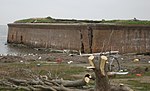
Fritchie Marsh is an area encompassing 6,291 acres of intermediate and brackish marsh located approximately three miles to the southeast of Slidell, Louisiana, USA. This wetland was originally documented as a freshwater marsh but has since been converted to a mixed intermediate and brackish marsh, and it threatens to become open salt water. Through the combined efforts of conservation groups and sponsors, the Fritchie Marsh Restoration Project was created and designed to restore the area to its original state. In the early years, this project showed a positive impact but soon suffered a devastating impact during Hurricane Katrina.
Excerpt from the Wikipedia article Fritchie Marsh (License: CC BY-SA 3.0, Authors).Fritchie Marsh
Geographical coordinates (GPS) Address Nearby Places Show on map
 Continue reading on Wikipedia
 Geographical coordinates (GPS)
| Latitude | Longitude |
|---|---|
| N 30.208 ° | E -89.726 ° |
Address
St. Tammany Parish
Louisiana, United States
Open on Google Maps