place

Lake St. Catherine (Louisiana)

Bodies of water of Orleans Parish, LouisianaLakes of Louisiana

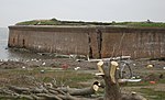
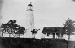
Lake St. Catherine (French: Lac Sainte-Catherine) is a brackish-water lake that is located in eastern Orleans Parish, within the city limits of New Orleans, between Lake Pontchartrain and Lake Borgne in Louisiana. Between Lake St. Catherine and Lake Borgne was the original Town of Lake Catherine. Established between Unknown Pass and Miller's Ditch, it was settled for railroad workers, trappers, hunters and fishermen.

Excerpt from the Wikipedia article Lake St. Catherine (Louisiana) (License: CC BY-SA 3.0, Authors).

Lake St. Catherine (Louisiana)
New Orleans

Geographical coordinates (GPS) Address Nearby Places
placeShow on map

Wikipedia: Lake St. Catherine (Louisiana)Continue reading on Wikipedia

Geographical coordinates (GPS)

Latitude Longitude
N 30.128611111111 ° E -89.738611111111 °
placeShow on map

Address

New Orleans


New Orleans
Louisiana, United States
mapOpen on Google Maps

Share experience

Nearby Places

New Orleans East
New Orleans East

New Orleans East (also referred to as N.O. East and The East) is the eastern section of New Orleans, Louisiana, the newest section of the city. This collection neighborhood sub divisions represents 65% of the city's total land area, but it is geographically isolated from the rest of the city by the Inner Harbor Navigational Canal (Industrial Canal). It is surrounded by water on all sides, bounded by the Industrial Canal, Gulf Intracoastal Waterway, Lake Pontchartrain, Lake Borgne, and the Rigolets, a long deep-water strait connecting the two lakes. Interstate 10 (I-10) splits the area nearly in half, and Chef Menteur Hwy, Downman Rd, Crowder Blvd, Dwyer Rd, Lake Forest Blvd, Read Blvd, Bullard Ave, Michoud Blvd, Hayne Blvd, Morrison Rd, Bundy Rd, and Almonaster Ave serve as major streets and corridors. As of the 2020 census, the population of eastern New Orleans is 75,223, accounting for 20% of the city’s total population (Table 1). Housing ranges from low-income multifamily apartment complexes and working-class neighborhoods to middle-class single-family subdivisions and affluent, lake-centered gated communities. Neighborhoods include Pines Village, Plum Orchard, Little Woods, West Lake Forest, Read Boulevard West, Read Boulevard East, Village de L’Est, Venetian Isles, and Lake Catherine (Fig. 2.). Economic drivers in this part of the city include the NASA Michoud Assembly Facility, New Orleans Lakefront Airport, Folgers Coffee Plant, Faubourg Brewing Co., Crescent Crown Distributing, the National Finance Center, and the New Orleans Regional Business Park. A notable characteristic of New Orleans East is its abundance of green spaces, including Bayou Sauvage Urban National Wildlife Refuge, Audubon Louisiana Nature Center, and Joe W. Brown Park.