Col du Granier
Mountain passes of Auvergne-Rhône-AlpesMountain passes of the Alps

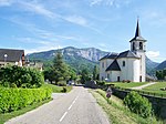
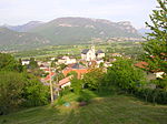
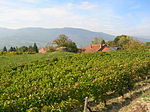
Col du Granier (el. 1,134 m.) is a mountain pass in the Alps in the department of Savoie in France which crosses the Chartreuse Mountains to connect the villages of Entremont-le-Vieux (south), Apremont (north) and Chapareillan (east). It has been traversed several times by the Tour de France cycle race, including on Stage 12 of the 2012 race. It is situated between Mont Granier (1,933 m) (south-east) and Mont Joigny (1,558 m) (north-west).
Excerpt from the Wikipedia article Col du Granier (License: CC BY-SA 3.0, Authors, Images).Col du Granier
D 285a, Chambéry
Geographical coordinates (GPS) Address Nearby Places Show on map
Geographical coordinates (GPS)
| Latitude | Longitude |
|---|---|
| N 45.480555555556 ° | E 5.9152777777778 ° |
Address
D 285a
73190 Chambéry (Les Marches)
Auvergne-Rhône-Alpes, France
Open on Google Maps


