Pontchartrain Park, New Orleans
Neighborhoods in New Orleans

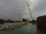
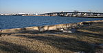
Pontchartrain Park is a historically registered neighborhood of the city of New Orleans. A subdistrict of the Gentilly District Area, its boundaries as defined by the City Planning Commission are: Leon C. Simon Drive to the north, the Industrial Canal to the east, Dreux Avenue to the south and Peoples Avenue to the west.
Excerpt from the Wikipedia article Pontchartrain Park, New Orleans (License: CC BY-SA 3.0, Authors, Images).Pontchartrain Park, New Orleans
Congress Drive, New Orleans Gentilly
Geographical coordinates (GPS) Address Nearby Places Show on map
 Continue reading on Wikipedia
 Geographical coordinates (GPS)
| Latitude | Longitude |
|---|---|
| N 30.021944444444 ° | E -90.040277777778 ° |
Address
Congress Drive
Congress Drive
70126 New Orleans, Gentilly
Louisiana, United States
Open on Google Maps