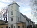
Old Town, Oslo

The Old Town of Oslo (Norwegian: Gamlebyen, pronounced [ˈɡɑ̂mɽəbʏn] (listen)) is a neighbourhood in the inner city of Oslo, Norway, belonging to the borough of Gamle Oslo and is the oldest urban area within the current capital. This part of the capital of Norway was simply called Oslo until 1925 while the city as a whole was called Kristiania. Oslo's old town was established with the urban structure around the year 1000 and was the capital of Norway's dominion in 1314. The main Old Town area (i.e. the southern and central parts of Old Town) has several ruins of stone and brick lying above ground, and large amounts of protected culture underground. The core area also has listed 1700s buildings. Towards Ekeberg slope and further up are some 17th and 18th-century wooden houses that are zoned for conservation under the Planning and Building Act, though there exist in the Old Town many four-storey brick houses, built at the end of the 1800s, and some heritage railway buildings from different eras.
Excerpt from the Wikipedia article Old Town, Oslo (License: CC BY-SA 3.0, Authors, Images).Old Town, Oslo
Bispegata, Oslo Gamle Oslo
Geographical coordinates (GPS) Address Nearby Places Show on map
Geographical coordinates (GPS)
| Latitude | Longitude |
|---|---|
| N 59.905555555556 ° | E 10.768333333333 ° |
Address
Bispegata 2
0192 Oslo, Gamle Oslo
Norway
Open on Google Maps


